Inside the book
Every Georgia river in this guide
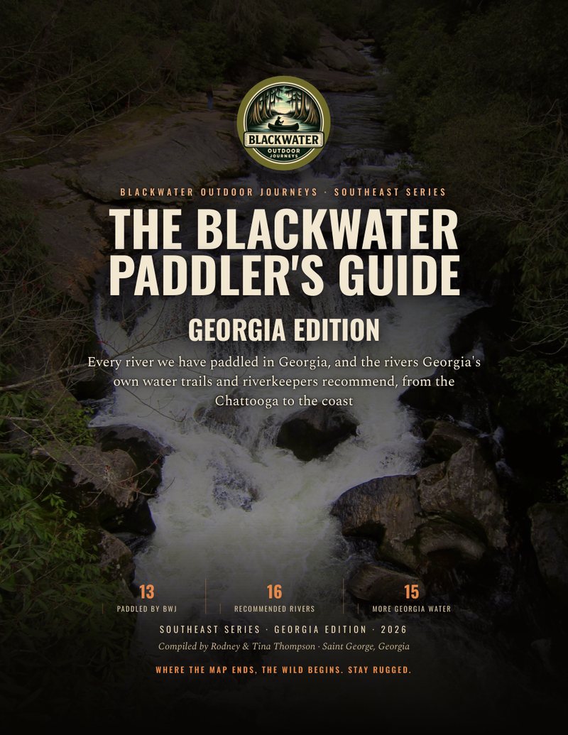
The Paddler's Guide covers 44 rivers, creeks and water trails in Georgia. Each entry below is taken from the book: the class and character of the water, best season, permits and access, the gauge to watch, runs with mileage, camping, hazards and who recommends it. Check the gauge and the source before you launch.
Paddled by BWJ
The Georgia rivers Tina and I have run, filmed and field-noted ourselves.
Paddled by BWJ
Okefenokee Swamp
Open peat prairies, cypress forest, blackwater lakes and narrow trail channels cut through the largest rain-fed lowland peatland in the world's subtropics. Most of the refuge is designated Wilderness. Overnight paddlers sleep on raised platforms out in the swamp or on two island sites -- seven platforms and two islands, one party per site per night.
- Class
- Easy but strenuous
- Best season
- Cooler months are the season: 1-4 night trips are available May through February, but only 1- and 2-night trips during the March-April peak. Water level governs everything -- low water exposes peat blowups and stumps and can close trails outright.
- Length
- Nearly 120 mi of designated Wilderness water trails inside a 407,000+ acre refuge.
- Permit and access
- Overnight Wilderness camping requires a permit, one party per platform per night, booked by phone with a Recreation.gov profile already created -- not booked online. Permit line 912-496-3331, Tuesday-Thursday 7-10 AM ET. Man-powered boats only overnight; no motors. Day use allows motors up to 10 HP on designated trails. Launch deadlines and on/off-water times vary by entrance -- check with the entrance you are using.
- Gauge
- No paddling gauge is published for the swamp. Water is rain-driven, the refuge reports trail conditions. Call 912-496-3331 (Tue-Thu, 7-10 AM ET) and confirm current trail status before every trip. Never treat a published trail as open.
- Outfitters
- Okefenokee Adventures at the Main/East Entrance (Suwannee Canal Recreation Area), 912-496-7156 -- canoe, kayak and jon boat rental plus guided trips. Okefenokee State Park at the West Entrance near Fargo, 912-637-5274. Overnight parties leaving a vehicle overnight on the west side must park at Okefenokee State Park, not the Sill lot, which is day-use only.
- Camping
- Seven overnight platforms (Bluff Lake, Big Water, Cedar Hammock, Canal Run, Buzzards Roost, Round Top, Maul Hammock) and two island sites (Floyds Island, Mixons Hammock). Every overnight site has a toilet. Campfires are permitted only where a fire ring is provided -- Canal Run, Floyds Island and Mixons Hammock. Everywhere else, cook on a stove.
- Hazards
- Peat blowups, stumps and encroaching vegetation in low water; narrow closed-in channels between prairies; wind exposure on the open prairies; alligators; heat, biting insects and sun with no shade on the prairie runs; and no potable water anywhere -- drinking or filtering swamp water is not recommended. Carry at least one gallon per person per day, as the refuge recommends. Cell coverage is inconsistent across the swamp.
- The runs
- Suwannee Canal Recreation Area → Cedar Hammock (Yellow Trail) (~3 mi · 1 night). In Mizell Prairie. A great first platform trip for families or newer paddlers.
Okefenokee State Park → Mixons Hammock (Brown Trail) (~2 mi · 1 night). An easy paddle across Billys Lake to an island site with a fire ring. The shortest overnight approach in the swamp.
Suwannee Canal Recreation Area → Coffee Bay day-use shelter (Orange Trail) (~6 mi one way · day trip). Down the historic Suwannee Canal to a day-use shelter. No permit needed for a day trip; stretch your legs and turn around.
Kingfisher Landing → Bluff Lake (Green Trail) (~8 mi · 1 night). Eight miles in to the platform, paddling across Bluff Lake at the end. Dark-sky camp.
Suwannee Canal Recreation Area → Canal Run (Orange Trail) (~10 mi · 1 night). The canal run, ending at a platform with an adjacent hammock and fire ring. Seven more miles out to Okefenokee State Park if you continue west.
Kingfisher Landing → Maul Hammock (Red Trail) (~12 mi · 1 night). A long, remote day. Look behind you entering Maul Hammock Lake to spot the platform.
Billys Lake → River Narrows → Suwannee River Sill (Brown Trail) (~5 mi to the Sill, ~3 mi more along it · day trip). Current in the River Narrows can make the return harder than the way in. No permit needed to cross the Sill.
Kingfisher Landing → Floyds Island → Okefenokee State Park (Green Trail) (~26 mi · 2-3 nights). Eight miles to Bluff Lake, about nine more to Floyds Island, then nine to the state park, with a 0.2-mile portage. The refuge's current alert says trips must begin and end at the same entrance, so this crossing cannot be booked while it stands.
1-Night Beginner: Suwannee Canal → Cedar Hammock (~3 mi, Yellow Trail)
- Day 1 , ~3 mi to the platform. The Yellow Trail was closed for low water in fall 2026, so confirm it is open on the permit line before you drive. Launch from the Suwannee Canal Recreation Area at the east entrance, paddle north of the canal into Mizell Prairie, and reach Cedar Hammock with the whole afternoon left. Open prairie views, toilet on the platform, no fire , cook on a stove.
- Day 2 , ~3 mi back out. Sunrise over the prairie, pack out everything, and be off the water inside the entrance's posted time.
Day 1 lunch: wraps and trail mix. Dinner: stove-cooked one-pot meal (no fire ring at Cedar Hammock). Day 2 breakfast: oatmeal and coffee on the stove. at least one gallon per person per day, carried in. There is no potable water in the refuge and filtering swamp water is not recommended.
Read the full Okefenokee Swamp page
Paddled by BWJ
St. Marys River
The signature home river , it runs right past St. George. Tea-colored water, white sugar-sand bars, cypress and hardwood banks, remote through much of its middle course.
- Class
- Easy Flatwater
- Best season
- Runnable most of the year in the middle course. Late winter into early spring and late summer give the most dependable water; May, June and November run lowest, and the upper river drops low in a dry spell.
- Length
- ~130 mi total, forming the Georgia-Florida line from the Okefenokee to the Atlantic.
- Permit and access
- No river permit is published. Sandbar camping is common on the middle river, and Traders Hill Recreation Area (Charlton County) has a campground. Banks are usually private, so camp only where you have the right to, above the waterline.
- Gauge
- USGS 02231000 , St. Marys River near Macclenny, FL, for flow, and NWS forecast point SMTG1 , St. Marys River at Traders Hill (water.noaa.gov/gauges/SMTG1) for stage at the takeout; USGS 02231175 at Traders Hill still reports stage live (its flow record ended in 2024). The tide reaches up to Traders Hill and is stronger below Camp Pinckney. Blackwater and rain-driven, so read the stage, the trend after rain and the NWS flood forecast together rather than any one number. Macclenny's action stage is 10 ft and flood stage 12 ft. The middle course runs most of the year; May, June and November run lowest. USGS 02228500 , North Prong at Moniac covers the swamp outflow at the top of the run.
- Outfitters
- Self-shuttle on the home run. Below Traders Hill, St. Marys River Fish Camp (Canoe Country Outpost) at Scotts Landing near Hilliard, FL runs shuttles and has a campground: 904-412-3001 or 904-982-7788 (Florida DEP paddling guide).
- Camping
- Elevated sandbars along the middle river; Traders Hill Recreation Area has amenities. Camp above the high-water line.
- Hazards
- Submerged logs and strainers, shifting sandbars, heat and remoteness, and , on the lower reach near St. Marys , tidal current and wind. Carry a whistle and backup light; cell service is limited.
- The runs
- St. George Boat Ramp (Bell Boat Ramp, GA 94 bridge) → Traders Hill Rec. Area (Folkston) (~30 mi · 2 days). Rodney's home run. Cypress-lined blackwater; camp on a high sandbar near the halfway point.
Traders Hill → Camp Pinckney Landing (GA Hwy 40) (~9 mi · day trip). Easy, scenic blackwater with good sandbar lunch stops. Watch for submerged logs.
Camp Pinckney → St. Marys (tidal lower river) (multi-day; mileage not published · plan by tide). Georgia Rivers marks it tidal below Camp Pinckney, turning to salt marsh near St. Marys. Carry a tide chart.
2-Day Home Run: St. George → Traders Hill (~30 mi)
- Day 1 , ~15 mi to a sandbar camp. Launch by 9 AM from the St. George ramp (GA-94), paddle cypress-lined blackwater, lunch on a sandy bank, and camp on a high sandbar by late afternoon.
- Day 2 , ~15 mi to Traders Hill. Early breakfast, on the water by 9 AM through the wider bends, lunch on a bar, arrive Traders Hill Recreation Area mid-afternoon. Camp Pinckney is the next Georgia landing below Traders Hill; Scotts Landing, Florida, comes first.
Day 1 lunch: turkey wraps, trail mix. Dinner: foil-packet potatoes & sausage, s'mores. Day 2 breakfast: pancakes, coffee. Lunch: crackers & peanut butter. Snacks: protein bars, dried fruit, jerky. 1 gallon per person per day. No treated refill points , bring it all.
Read the full St. Marys River page
Paddled by BWJ
Satilla River
The quintessential Georgia blackwater , deep tea-colored water, huge white sugar-sand bars, cypress and pine, remote and lightly developed. It runs entirely within Georgia, and it is a sandbar-camper's dream.
- Class
- Class I Flatwater
- Best season
- Winter and spring give the most dependable water. Summer exposes broad sandbars but can run shallow.
- Length
- About 200 mi, entirely within Georgia (Georgia River Network).
- Permit and access
- No river permit is published. Discover Georgia Outdoors says camping is allowed on public banks and sandbars. Banks and bluffs are usually private, so camp only where you have the right to, above the waterline, and pack out everything.
- Gauge
- Two gauges, per the Satilla Riverkeeper: USGS 02226500 (near Waycross) governs the upper landings , ideal paddling 6-10 ft, flood 16 ft (NWS); USGS 02228000 (near Atkinson) governs the lower landings , ideal 4-9 ft depending on section, flood 13 ft. Never launch at flood; the Satilla loses its sandbars and gains dangerous current fast.
- Outfitters
- No river-wide livery , arrange your own shuttle between landings. The Satilla Riverkeeper publishes the current landing list and levels.
- Camping
- Sandbars are the campsites , pick a high one, well above the current water level, and leave no trace.
- Hazards
- Strainers, shifting or hidden sandbars, flood current, heat, remoteness, alligators, and private frontage. Watch for snakes and ticks on the bars , wear long pants.
- The runs
- GA 121 bridge to FFA Camp Landing (Patterson) (about 10 river miles · 2 nights). Our winter trip. FFA Camp Landing is a concrete ramp off Turkey Ridge Rd, at the end of sandy clay roads. Downed pines blocked the river in several places, including a 200-yard portage. Scout it before you commit.
2 Nights: GA 121 Bridge to FFA Camp Landing (about 10 mi)
- Launch at the GA 121 bridge. A local warned us about downed trees about three miles in, and he was right: two big pines bank to bank sent us on a 200-yard portage. Camp on the first good high sandbar.
- More pines below that. We lifted the canoe over some and waded in to clear others. Keep the day short and take the right sandbar when you see it.
- Finish at FFA Camp Landing, a public concrete ramp off Turkey Ridge Rd. The last stretch of the drive in is sandy clay road.
Pack all food. Carry all drinking water.
Read the full Satilla River page
Paddled by BWJ
Suwannee River (Georgia)
The first miles of the Suwannee, born at the edge of the Okefenokee. From the Sill it runs as a narrow, shallow blackwater stream through cypress and swamp forest to Fargo, where it widens into the river Florida knows.
- Class
- Moving Water , seasonal
- Best season
- When the water is up. Check the Fargo gauge before every trip; this reach gets shallow fast.
- Length
- About 17 miles, the Sill (river mile 237.9) to Fargo (river mile 221), per WWALS.
- Permit and access
- No permit to cross the Sill. Sill parking is day-use only; overnight parties park at Okefenokee State Park. You may not carry a boat from the river into the refuge.
- Gauge
- USGS 02314500, Suwannee River at US 441 at Fargo. WWALS / Suwannee Riverkeeper publish a range at Fargo: 92.5 ft NAVD88 is the lowest boatable level and 100 ft the highest safe. The old gauges at the Sill are no longer running.
- Outfitters
- No outfitter is published for this reach. Self-shuttle between the Sill and the Fargo ramp.
- Camping
- Griffis Fish Camp, about 3 mi below the Sill, has fee campsites (229-412-0558). Otherwise plan one long day.
- Hazards
- Low water and narrow channels, so expect to push over or drag. Deadfall and downed trees, including near Fargo. Alligators. Remote, with few bail-outs between the Sill and Fargo.
- The runs
- Suwannee River Sill (GA 177) to Fargo Ramp (US 441) (~17 mi · long day). Portage over the Sill. Narrow and shallow, with deadfall. Off the water before dark; Sill parking is day-use only.
1-Day: Suwannee River Sill to Fargo (~17 mi)
- Launch below the Suwannee River Sill off GA 177 early and paddle about 17 miles of narrow blackwater to the Fargo ramp at US 441. Check the Fargo gauge first: under 92.5 ft you will be dragging. Leave the shuttle vehicle at Fargo; the Sill lot is day-use only.
Packed lunch and snacks. There is nowhere to stop for food on this reach. One gallon per person for the day.
Read the full Suwannee River page
Paddled by BWJ
Altamaha River
Georgia's largest free-flowing river , "Georgia's Little Amazon." Formed where the Oconee and Ocmulgee meet near Lumber City, it runs wide, brown, and powerful to the coast through bottomland forest, sloughs, and finally salt marsh. Big-water flatwater with real current, remote camps, and a tidal, motor-trafficked lower reach.
- Class
- Flatwater / Tidal Lower Reach
- Best season
- Runnable year-round thanks to its size. Spring and fall are most comfortable; summer brings heat and afternoon storms, and the lower reach needs tide planning.
- Length
- 138-mi water trail with 29 access points, Lumber City to the Atlantic.
- Permit and access
- No permit is published for the water trail. Sandbar camping is common on the middle river. On state wildlife management areas, camp only where the WMA rules allow it, and check the hunting seasons.
- Gauge
- USGS 02226000 , Altamaha River at Doctortown, GA. Because it drains most of central Georgia, the Altamaha almost always has paddling water , the number you watch for is FLOOD, not low water. High flows bring strong current, buried sandbars, and debris; the lower river toward Darien is tidal, so plan that stretch around the tide, not just the gauge.
- Outfitters
- Altamaha Coastal Tours (Darien) , rentals, shuttles, and guided marsh trips on the lower river.
- Camping
- Sandbars on the middle river and designated WMA areas along the corridor; state-managed landings for access. Camp above the waterline; the lower reach has few dry camps once you're in the marsh.
- Hazards
- Motorboat traffic on the lower river, tidal current and wind toward Darien, strong current and debris at high water, alligators, heat, and easy-to-miss sloughs , stay with the main channel.
- The runs
- Jaycee Landing (Jesup, US 84) → Altamaha Regional Park (~36 mi · 2-3 days). Popular access with a ramp; classic big-river bottomland paddling. About 36 river miles from Jesup down to the park.
Everett City → Darien (~18 mi tidal · plan by tide). Tidal salt-marsh finish into Darien; time the current and the wind.
Read the full Altamaha River page
Paddled by BWJ
Oconee River
Below Sinclair Dam the Oconee runs free for about 143 miles to the Ocmulgee confluence. Wide, sandy and increasingly remote as it goes south, below the Fall Line at Milledgeville it runs as a coastal-plain river.
- Class
- Class I Flatwater
- Best season
- Best in spring and early summer. Flow below Sinclair Dam is release-dependent -- check the dam schedule as well as the gauge.
- Length
- About 143 mi of free-flowing river from Sinclair Dam to the Ocmulgee confluence.
- Permit and access
- No permit. Beaverdam Wildlife Management Area provides a public landing on the lower river; WMA rules apply there.
- Gauge
- USGS 02223000 at Milledgeville governs the upper free-flowing section, 02223500 at Dublin the middle, and 02224500 near Mount Vernon the lower river above the confluence. Releases from Sinclair Dam move the upper river independently of rainfall.
- Outfitters
- Oconee Outfitters, 112 North Wayne Street, Milledgeville, 478-452-3890 , van shuttle, delivery to the launches, kayaks, canoes and paddleboards. Outfitters also serve the Athens area upstream and the Forks area where the Oconee and Ocmulgee meet.
- Camping
- Sandbars. At low water in September 2026 there was a big bar on nearly every inside bend below US-280, but few trees on them to hang a hammock or tarp, so bring a tent. Some bars have deep mud between the water and the sand. Walk a bar for gator tracks and slide marks before you unload; we passed on one for that reason. Camp well above the waterline.
- Hazards
- Sinclair Dam releases can raise the upper river quickly -- check the release schedule, not just the gauge. One abandoned diversion dam sits near Milledgeville. Strainers and long gaps between verified access points.
- The runs
- US-280 (Mount Vernon) → Bells Ferry Landing (24 mi · 4 days). The last miles of the river, paddled and verified September 2026: 12 miles to Clark's Bluff Landing, then 12 more to Bells Ferry, the last boat ramp on the Oconee before it meets the Ocmulgee. At low water it runs wide and shallow over the sand with deep water against the high banks on the outside of the bends, so you cross back and forth to stay off the bottom, and you will walk the boat through the skinny spots.
Read the full Oconee River page
Paddled by BWJ
Ocmulgee River
A big, wide coastal-plain river with sandbars, sweeping bends and long remote stretches between landings. The Ocmulgee Water Trail runs the whole river to the Oconee confluence at Lumber City, where the two rivers form the Altamaha; at 240+ miles it is the longest continuous water trail in Georgia.
- Class
- Class I Flatwater
- Best season
- Runnable year-round. Spring gives the most reliable water; late summer drops it and exposes the sandbars.
- Length
- About 200 river miles from Macon to the Oconee confluence. The Ocmulgee Water Trail covers the whole river, 240+ miles from Lake Jackson to the confluence.
- Permit and access
- No permit. Several landings allow overnight camping, James Dykes Memorial Park, Mile Branch Park, Sandy Hammock and Mobley Bluff among them. The two Macon landings are daylight-only.
- Gauge
- Four USGS gauges bracket the Macon-to-Lumber-City stretch: 02213000 at Macon, 02215000 at US 341 in Hawkinsville, 02215260 at Abbeville, and 02215500 at Lumber City. Check the gauge nearest your put-in before committing to a long segment -- some of these runs are 20 miles with no exit.
- Outfitters
- No river-wide livery. Shuttle between the numbered public landings yourself; the Ocmulgee Water Trail partnership publishes the landing map.
- Camping
- Sandbars and a handful of landings with improved camping. Mile Branch Park has restrooms and hot showers; James Dykes has tent and RV sites with no fee; Dodge County Landing is remote and lists no camping.
- Hazards
- Long unbroken gaps between landings -- the Dodge's Lake to Mobley Bluff segment is over 20 miles with no exit. Several access roads are dirt and impassable when wet, and Flat Tub's ramp sits in a slough that may be unusable in high water. Strainers, motorboat traffic near town landings, heat and no shade mid-river.
- The runs
- Westlake Landing → James Dykes Memorial Park (~8.4 mi · day trip). Ends inside the Ocmulgee WMA at a landing with tent and RV camping, a pavilion and no fee -- the best overnight-friendly takeout on the upper trail.
Dodge's Lake Landing → Mobley Bluff Landing (~20.1 mi · 2 days). One of the longer gaps between landings. Treat it as an overnight, not a day trip, and carry water.
Amerson Waterworks Landing → Spring Street Landing (Macon) (~4.0 mi · day trip). The in-town run through Macon, with direct access to the Ocmulgee Heritage Trail at the takeout. Both landings are daylight-only, no overnight parking.
Knowles Landing → Westlake Landing (~8.0 mi · day trip). Twiggs and Houston county river. Westlake's access road is dirt and often impassable after rain -- check it before you shuttle.
Uchee Shoals Landing → Mile Branch Park (Hawkinsville) (~1.1 mi · short day trip). The shortest hop on the trail. Mile Branch Park has restrooms, showers, tent camping and overnight parking -- a good base.
Mile Branch Park → Sandy Hammock Landing (~14.2 mi · long day). A full day on open river. Sandy Hammock is reached by 1.5 miles of dirt road off GA 230.
Dodge County Landing → Half Moon Landing (Abbeville) (~8.6 mi · day trip). Dodge County Landing allows overnight parking.
Burkett's Ferry Landing → Lumber City Landing (~8.0 mi · day trip). The last easy run before the Oconee comes in and the Altamaha begins. Lumber City Landing sits just off US 341.
Read the full Ocmulgee River page
Paddled by BWJ
Alapaha River
A wild, sandy, seasonal blackwater river that runs hard after rain and disappears into the limestone aquifer in dry spells , parts of the bed can go bone-dry. When it's up, it's fast, twisting, sandbar-lined, and gorgeous.
- Class
- Moving Water , seasonal
- Best season
- Winter and early spring after rain. This is a rain-dependent river , it can be unrunnable for much of a dry year, so watch the gauge and recent rainfall closely.
- Length
- ~200 mi from central Georgia to the Suwannee.
- Permit and access
- No permit. Sandbar camping is common; banks and bluffs are usually private, so camp only where you have the right to, on high ground.
- Gauge
- USGS 02316000 , Alapaha River near Alapaha, GA (US 82, the Sheboggy boat ramp), and USGS 02317500 , Alapaha River at Statenville, GA. Use the WWALS / Suwannee Riverkeeper ranges for whichever gauge is nearest your run: at the Alapaha (Sheboggy) gauge, 7.7 ft is the lowest boatable level and 10.6 ft the highest safe; at Statenville, 2.0 ft, with a highest-safe level of 7.0 to 10.0 ft depending on where you launch; at Irwinville (USGS 02315920), 1.8 ft and 5.9 ft. Below the floor you are dragging; above the ceiling it is pushy and the strainers are in play. The Alapaha only holds paddling water a handful of weeks to months a year , never assume it is running without checking.
- Outfitters
- No outfitter , self-shuttle. WWALS Watershed Coalition (Suwannee Riverkeeper) publishes access points and level guidance.
- Camping
- High sandbars on the multi-day run. Camp well above the water , this river rises fast.
- Hazards
- Fast current and strainers when it's up; a rapidly changing level; long dry stretches when it's down; remoteness and limited cell service.
- The runs
- Lakeland Boat Ramp (GA-122) → Statenville Boat Ramp (~41 mi · 3 days). The classic multi-day: blackwater channels, oxbows and sandbar camps.
3-Day: Lakeland (GA-122) → Statenville (~41 mi)
- Day 1 , ~15 mi from the Lakeland Boat Ramp (GA-122) through blackwater channels and oxbows; camp on a high sandbar, well above the waterline.
- Day 2 , ~14 mi of forested river with long quiet reaches; lunch at an oxbow, camp on a high sandbar.
- ~12 mi through wider sections to Statenville Boat Ramp (GA-94). Check the Statenville gauge before you launch: 2.0 ft is the WWALS floor.
Day 1: turkey wraps; sausage & potatoes dinner. Day 2: pancakes; pasta dinner. Day 3: oatmeal; tuna wraps. Snacks: jerky, protein bars. 1 gallon per person per day.
Read the full Alapaha River page
Paddled by BWJ
Withlacoochee River (South GA / North FL)
The northern Withlacoochee , draining out of south Georgia past Valdosta and across the Florida line to meet the Suwannee at Ellaville. Tannic and flashy up top, then limestone bluffs, shoals, and blue springs as it nears the Suwannee. Not to be confused with the central-Florida river of the same name.
- Class
- Easy , with limestone shoals
- Best season
- Late winter and spring after rain up top; the spring-fed Florida reach near Madison Blue holds water more steadily.
- Length
- About 115 mi; the WWALS water trail covers the lower 97.6 mi, about 70 of them in Georgia, above the Florida line.
- Permit and access
- No permit. Primitive camping in Twin Rivers State Forest and on sandbars; Madison Blue Spring SP nearby for day use.
- Gauge
- USGS 02319000 , Withlacoochee River near Pinetta, FL. WWALS / Suwannee Riverkeeper range at Pinetta: 6.0 ft is the lowest boatable level, 15.0 ft the highest safe. Upstream, use the Quitman (US 84) gauge, USGS 02318500: 2.0 ft floor, 10.5 ft ceiling; and Skipper Bridge above Valdosta, USGS 023177483: 2.3 ft floor, 10.7 ft ceiling. Below the floor expect long drags over limestone; above the ceiling the current is fast and the trees are in the water.
- Outfitters
- No full-time livery , self-shuttle. WWALS Watershed Coalition (Suwannee Riverkeeper) maintains the access list and levels.
- Camping
- Twin Rivers State Forest access and high sandbars; Madison Blue Spring State Park for a day stop and swim.
- Hazards
- Limestone shoals and outcrops, flashy current after rain, strainers, and low water in drought. Limited cell service.
- The runs
- Troupville Boat Ramp (Valdosta) → State Line Boat Ramp (Georgia section). Blackwater through the Little/Withlacoochee confluence country; WWALS publishes the access table.
Read the full Withlacoochee River page
The Mountains
Whitewater and cold trout water in the Blue Ridge. Recommended by the Forest Service, American Whitewater, Georgia State Parks and Georgia River Network. We have not paddled these yet.
Recommended · The Mountains
Chattooga River
A National Wild and Scenic River on the Georgia and South Carolina line, with no roads or towns along most of the lower run. Section 3 is the classic intermediate day. Section 4 holds Bull Sluice and the Five Falls, and it is for experienced whitewater paddlers only.
- Class
- Class II to IV+
- Where
- Georgia and South Carolina line, near Clayton, GA
- Best season
- Below Highway 28, year-round. Above Highway 28 the season is limited and needs 350 cfs or more at Burrells Ford; sources differ on the months.
- Length
- 58 miles of Wild and Scenic river. Other sources give 57.
- Permit and access
- Free self-registration for every party, at the put-in. Carry your copy in a dry bag. PFDs on Sections 3 and 4, and at least two boats below Earls Ford.
- Gauge
- USGS 02177000 near Clayton covers Sections 3 and 4. USGS 02176930 at Burrells Ford covers the upper river, which needs 350 cfs or more (Forest Service). American Whitewater says Section 4 gets scrapy near 0.5 ft and Five Falls pushes toward Class V above 2.0 ft. Read it live in the CWS app before you launch.
- Outfitters
- Southeastern Expeditions (Clayton, GA), Nantahala Outdoor Center (Mountain Rest, SC), Wildwater (Long Creek, SC) and Chattooga Whitewater Shop (Long Creek, SC).
- Camping
- Allowed in the river corridor away from roads, trails and the water, unless signs close an area. Check current rules with the Chattooga River Ranger District in Clayton before you go.
- Hazards
- Undercut rocks and sieves. Five Falls, Crack in the Rock, Ravens Chute and Woodall Shoals have all killed people. High water makes both sections much harder. This river is not a beginner run.
- The runs
- Section 3: Earls Ford to Route 76 Bridge (12 mi). Class II to III+, one Class IV. Shorter days from Sandy Ford or Thrifts Ferry.
Section 4: Route 76 Bridge to Tugaloo Lake (8.4 mi). Class II to IV+. Bull Sluice at the put-in, Five Falls near mile 5. Experienced only. - Put-ins and take-outs
- Highway 76 put-in (Bull Sluice access) (put-in / take-out); Woodall Shoals access; Camp Creek (emergency access, river right); Earls Ford (put-in / take-out); Sandy Ford (put-in / take-out); Fall Creek (emergency use, long steep trail) (emergency access); Thrifts Ferry (put-in); Highway 28 Boat Launch (put-in / take-out); Long Bottom Ford (access); Burrells Ford Bridge (Georgia side); Overflow Creek, West Fork, GA
- Recommended by
- Georgia River Network (established water trail); American Whitewater; USDA Forest Service (Wild and Scenic River)
Suggested: Section 3, Earls Ford to Route 76 (12 mi)
- Register at Earls Ford and run about 12 miles of Class II to III+ through the protected corridor to the Route 76 bridge. Check the Clayton gauge first. For a shorter day, put in at Sandy Ford or Thrifts Ferry.
Packed lunch and snacks. Keep your permit copy in the dry bag. One gallon per person for the day.
Recommended · The Mountains
Tallulah Gorge
A granite gorge nearly 1,000 feet deep below a Georgia Power dam, and the only Georgia state park with whitewater releases. American Whitewater says the gradient runs better than 200 feet per mile. Oceana and Bridal Veil are the named drops.
- Class
- Class IV to V, experts
- Where
- Tallulah Gorge State Park, Tallulah Falls, GA
- Best season
- Release weekends only: the first two weekends of April and the first three of November, 10 a.m. to 4 p.m. 2026 dates: Nov 7-8, 14-15, 21-22.
- Length
- About 1.3 miles of gorge, then a paddle across Tugalo reservoir. Other sources give 3.4.
- Permit and access
- Georgia State Parks parking pass. Gorge-floor hiking permits are not issued on release days. Call the park to confirm boater check-in before you go.
- Gauge
- USGS 02181580 above the powerhouse is the gorge gauge. Normal flow is 35 to 40 cfs. Georgia State Parks sets releases at 500 cfs on Saturday and 700 cfs on Sunday, and American Whitewater notes 1,000 cfs has come down when 700 was planned. Read it live in the CWS app before you launch.
- Outfitters
- None. This is a self-run expert release. Nantahala Outdoor Center posts the release schedule.
- Camping
- The state park campground has 52 tent, trailer and RV sites.
- Hazards
- Class V skills required. Oceana is usually scouted and has a piton at the broken shelf. Bridal Veil has a deep hole and is portaged left. The put-in is a 592-step carry. Releases can run higher than planned.
- The runs
- Tallulah Gorge to the Tugaloo Lake take-out (1.3 mi). Class IV to V on release days only. Carry down 592 stairs; paddle the lake to the take-out before the dam.
- Put-ins and take-outs
- Tallulah Gorge boater put-in (dedicated boater lot, stairs to the river); Tugalo reservoir take-out, right bank shortly before the dam
- Recommended by
- Georgia State Parks (whitewater release weekends); American Whitewater
Suggested: Release-day gorge run (1.3 mi)
- On a release day, park in the boater lot and follow park staff. Carry down the 592 stairs, run the gorge, then paddle across Tugalo reservoir and take out on the right before the dam. Experts only.
Packed lunch and snacks you can carry down the stairs. Two liters per person, carried in the boat.
Recommended · The Mountains
Toccoa River Canoe Trail
A Forest Service canoe trail through national forest and farmland, with laurel and rhododendron on the banks, trout water, a handful of rapids and a swinging bridge. It ends where the river meets Lake Blue Ridge.
- Class
- Class I to III
- Where
- Chattahoochee National Forest, near Blue Ridge, GA
- Best season
- Year-round on the canoe trail. Below Blue Ridge Dam the float depends on TVA's generation schedule.
- Length
- 13.8 miles, Deep Hole to Sandy Bottoms.
- Permit and access
- No paddling permit. Deep Hole parking is $5 a vehicle. Sandy Bottoms needs a day pass and no longer takes cash or checks on site.
- Gauge
- USGS 03558000 near Dial sits on the canoe trail. American Whitewater lists 350 to 10,000 cfs as runnable for this run. Read it live in the CWS app before you launch.
- Outfitters
- Rolling Thunder River Company and Toccoa River Tubing (McCaysville), Jon Ron Toccoa River Outfitters (Cherry Log), Blue Ridge Mountain Kayaking and Lake Blue Ridge Outfitters (Morganton).
- Camping
- Forest Service campgrounds at Deep Hole (nine sites, reserve on Recreation.gov) and Sandy Bottoms (reservations required). The Fannin County Chamber names the Swinging Bridge as a camp spot.
- Hazards
- Rapids between Margret and Butt Bridge. Below Blue Ridge Dam the water rises when TVA generates. Know the schedule before you float the tailwater.
- The runs
- Canoe Trail: Deep Hole to Sandy Bottoms (13.8 mi). The rapids and the swinging bridge are in the 5.8 miles from Margret to Butt Bridge.
Blue Ridge Dam tailwater to McCaysville (Not published). Class I to II when the dam is generating. A separate float from the canoe trail. - Put-ins and take-outs
- Deep Hole Recreation Area (put-in / campground); Rock Creek Road Bridge (access); Margret (access); Swinging Bridge (camping) (campsite); Butt Bridge (access); Dial Bridge (access); Toccoa River Sandy Bottoms (take-out / campground); Blue Ridge Dam Canoe Access; Curtis Switch; Horseshoe Bend Park, McCaysville; McCaysville City Park
- Recommended by
- Georgia River Network (established water trail); USDA Forest Service; Fannin County Chamber
Suggested: Deep Hole to Sandy Bottoms (13.8 mi)
- Launch at Deep Hole. Rock Creek Road Bridge is 1.5 miles, Margret 1.0 more, then 5.8 miles of rapids past the swinging bridge to Butt Bridge. Dial Bridge is 1.5 miles on, and Sandy Bottoms 4.0 after that.
- Run it in one long day, or camp at the swinging bridge and finish the next morning.
Packed lunch and trail snacks for a long day, or a simple camp dinner if you split it. One gallon per person per day.
Recommended · The Mountains
Upper Chattahoochee River
Clean, cold water in the Blue Ridge foothills. The trail starts on Sautee Creek and runs through Class I and II rapids and pools before the river slows into the backwater of Lake Lanier. Section 3 is the whitewater day and the most popular run.
- Class
- Class I to II (III)
- Where
- Sautee Valley to Lake Lanier, near Helen and Cleveland, GA
- Best season
- Year-round. Wildwood Outfitters runs weekends in spring and fall and daily from Memorial Day through August.
- Length
- 36.2 miles, in six sections.
- Permit and access
- No paddling permit. Some access is state park land that needs a day or annual pass. Group camping at Buck Shoals needs a GA DNR permit.
- Gauge
- USGS 02331000 near Leaf is the paddlers' gauge. American Whitewater calls 1.5 to 2 feet low but runnable, 2 to 3 feet good for most paddlers, 3 to 4 feet Class III, and over 4 feet high water with big holes. USGS 02330450 at Helen and 02331600 near Cornelia are also live. Read it live in the CWS app before you launch.
- Outfitters
- Wildwood Outfitters on Duncan Bridge Road, Cleveland, at the Section 3 take-out. Tubing outfits operate in Helen.
- Camping
- Group camping at Buck Shoals State Park with a GA DNR permit. Don Carter State Park campground on Lake Lanier.
- Hazards
- Wear a PFD, and a helmet in a kayak. Smith Island Shoals is a Class II in Section 2, and Section 3 has three Class II (III) rapids. Only road crossings and parks are public; respect private banks.
- The runs
- Section 1: Sautee Creek (GA 17) to GA 255 (5.4 mi). Class I. A lively mountain stream to start.
Section 2: GA 255 to GA 115 (4.2 mi). Class I (II). Smith Island Shoals is the one Class II.
Section 3: GA 115 to Wildwood Outfitters (4 mi). Class II (III). The whitewater section and the most popular run. - Put-ins and take-outs
- Sautee Creek Bridge on GA Hwy 17 (Section 1 put-in) (road crossing put-in); Hwy 255 Bridge (road crossing access); Hwy 115 Bridge (road crossing access); Wildwood Outfitters, Duncan Bridge Rd (Hwy 384) (outfitter take out / put-in); Buck Shoals State Park (group camping) (state park, camping for groups only); Mossy Creek State Park (state park put-in/take-out option at the 5 mile mark of Section 4); Belton Bridge (road crossing take out); Lula Park Bridge (Hwy 52) (road crossing access); Clarks Bridge Park (Hwy 284), Olympic Rowing Center (park take out on Lake Lanier); Don Carter State Park (camping)
- Recommended by
- Chattahoochee Riverkeeper (water trail and paddle card); Georgia River Network (established water trail)
Suggested: Section 3, GA 115 to Wildwood (4 mi)
- Put in at the GA 115 bridge and run 4 miles to Wildwood Outfitters on Duncan Bridge Road, with three Class II (III) rapids. Check the Leaf gauge first. For a gentler day, run Section 1, 5.4 miles of Class I.
Packed lunch and snacks. Two liters per person for a half day.
The Piedmont & Northwest
Shoals, water trails and big-city rivers, from Rome to the Chattahoochee through Atlanta. Recommended by the Park Service, county water trails and Georgia River Network.
Recommended · Piedmont & Northwest
Etowah River
A long water trail from the Blue Ridge foothills to Rome, through Lake Allatoona. It holds more Native American fish weirs than any other Georgia river, runs past the Etowah Indian Mounds, and its Tunnel Section passes through a quarter-mile gold mine tunnel. The Bartow County reach is easy water for newer paddlers.
- Class
- Flatwater to Class IV
- Where
- Dahlonega to Rome, north and northwest Georgia
- Best season
- Year-round.
- Length
- 163 miles from Lumpkin County to Rome, about 156 of them navigable.
- Permit and access
- No paddling permit. Some landings charge a small fee. Respect private property between the public launches.
- Gauge
- Ten USGS gauges report live flow on the river. For the Bartow County trips below, use 02394670 near Cartersville and 02395000 near Kingston. For the upper whitewater sections, American Whitewater points to 02388975 near Landrum and 02389150 near Dawsonville. Read it live in the CWS app before you launch.
- Outfitters
- Euharlee Creek Outfitters (Euharlee), River Ratz (Rome), Appalachian Outfitters (Dawsonville), Nomadic Flow Outfitters (Cumming) and Holiday Harbor Marina (Acworth).
- Camping
- No river camping is published for the Etowah. Plan it as day trips or arrange lodging.
- Hazards
- Etowah Falls is Class IV. Scout the tunnel for light at the far end. Deadfall and logjams on several reaches, and a washed-out steel bridge blocks the Hightower section. Launches are far apart in Bartow County. Below Allatoona Dam the river rises fast on releases, so check the Corps release schedule before you launch.
- The runs
- Leake Mounds to Euharlee Road landing (8 mi). Bartow County's first leg, easy water past the mounds.
Euharlee Road landing to Neels Landing (9 mi). Hardin Bridge launch sits between the two.
Neels Landing to Dixon Landing, Rome (16 mi). A long leg between launches. Plan the full day. - Put-ins and take-outs
- River Park (launch / take-out); Kelly Bridge Canoe and Kayak Launch (launch / take-out); Leake Mounds Landing (launch); Euharlee Road (launch); Hardin Bridge (launch); Neels Landing (launch); Dixon Landing (launch / take-out); Heritage Park (take-out)
- Recommended by
- Georgia River Network (established water trail); Bartow County; American Whitewater; Georgia's Rome
Suggested: Leake Mounds to Neels Landing (17 mi)
- Launch at Leake Mounds in Cartersville and paddle about 8 miles to the Euharlee Road landing.
- Euharlee Road landing to Neels Landing near Kingston, 9 miles. There is no published river camping, so plan lodging between days.
Packed lunches and snacks each day. One gallon per person per day.
Recommended · Piedmont & Northwest
Coosa River at Rome
The Coosa is born in downtown Rome, where the Etowah and the Oostanaula meet. Rome promotes all three rivers for kayaking, canoeing, tubing and fishing, with local rental, tube and shuttle services listed for the town floats.
- Class
- Calm water
- Where
- Downtown Rome, Floyd County, northwest Georgia
- Best season
- No paddling season is published. Check the level before you go.
- Length
- A short town float. No trail length is published for the Georgia Coosa.
- Permit and access
- No paddling permit.
- Gauge
- USGS 02397000 at Mayos Bar is the gauge on the Coosa itself. The Etowah and Oostanaula each have live gauges in Rome. No paddling range is published for this river. Read it live in the CWS app before you launch.
- Outfitters
- No current Coosa-specific guided service or rental listing was confirmed in the sources read. A Cave Spring outfitter lists rentals, shuttles, float trips and camping.
- Camping
- RV and primitive camping at Lock and Dam Park on the Coosa.
- Hazards
- Coming down from Heritage Park, get out on river left before the lock and dam. There is exposed rebar at the dam.
- The runs
- Lock and Dam Park, Rome (Day use). Named Coosa access and camping point. Check current conditions and local rules before launching.
- Put-ins and take-outs
- Lock and Dam Park (park / ramp)
- Recommended by
- Coosa River Basin Initiative; Georgia's Rome
Recommended · Piedmont & Northwest
Dub Denman Canoe Trail
A narrow, rural river with mostly flat water, a few Class I shoals, tall bluffs, rock islands and swimming holes. The Haralson Chamber calls it one of the cleanest rivers in west Georgia. It is named for Dub Denman, who pushed to open it to paddlers.
- Class
- Flatwater, Class I shoals
- Where
- Tallapoosa River, Haralson County, west Georgia
- Best season
- Year-round.
- Length
- 14.3 miles of water trail. Other sources give about 27 miles in the county.
- Permit and access
- No paddling permit.
- Gauge
- USGS 02411930 at US 78 near Tallapoosa sits right on the trail. No paddling range is published for this river. Read it live in the CWS app before you launch.
- Outfitters
- Lazy River Rentals of West Georgia in Tallapoosa. Tallapoosa River RV and Outdoor Center across the line in Heflin, AL.
- Camping
- No river camping is published. Plan it as a day trip.
- Hazards
- A small obstruction at the GA 100 bridge; portage and stay left. Shoals and strainers near miles 1.2, 2.3, 2.9, 3.9 and 6.9. The upper reach is classed as a drinking water source, not a swimming river.
- The runs
- Poplar Springs Road to GA 100 (2 to 3 hours). Portage the obstruction at the GA 100 bridge, staying left.
GA 100 to Broad Street (McBride Bridge) (4.4 mi). Shoals and a strainer near mile 1.2, another strainer near 2.9.
Broad Street to Lazy River Rentals (5.4 mi). About three hours. The outfitter runs shuttles. - Put-ins and take-outs
- Poplar Springs (launch); GA Highway 100 (launch); Broad Street (launch / take-out)
- Recommended by
- Georgia River Network (established water trail); Greater Haralson Chamber; Explore Georgia
Suggested: GA 100 to Lazy River Rentals (9.8 mi)
- Launch at GA 100 and float 4.4 miles, two to three hours, to Broad Street. Continue 5.4 miles, about three hours more, to the Lazy River Rentals access. Book your shuttle with Lazy River before you go.
Packed lunch and snacks. Swimming holes make a good lunch stop. One gallon per person for the day.
Recommended · Piedmont & Northwest
Chattahoochee River NRA
The first designated National Water Trail in the country, running right through metro Atlanta. Mostly calm water with Class I and II shoals when Buford Dam is not releasing. The river comes off the bottom of Lake Lanier, so it runs cold and holds trout.
- Class
- Flatwater to Class II
- Where
- Buford Dam to Atlanta, north metro Atlanta
- Best season
- Year-round, from 30 minutes before sunrise to 30 minutes after sunset. No night boating.
- Length
- 48 miles inside the National Recreation Area.
- Permit and access
- No paddling permit. A park pass is $5 a day per vehicle (or per person 16 and up on foot or bike), or $40 a year. Wear a life jacket from Buford Dam to the GA 20 bridge and from Morgan Falls Dam to the Morgan Falls ramp; everywhere else carry one for every person, and children under 13 must wear one.
- Gauge
- Six live USGS gauges. The Park Service says to use 02334430 at Buford Dam for the upper launches, 02335000 near Norcross for Medlock and Jones Bridge, and 02335815 below Morgan Falls for the lower river. It advises canoes and kayaks stay off above 4,000 cfs. Read it live in the CWS app before you launch.
- Outfitters
- Park Service authorized: Nantahala Outdoor Center (Roswell), Chattahoochee River Tubing, and REI Perimeter for rentals; REI also runs shuttles. High Country Outfitters is in Sandy Springs.
- Camping
- No river camping in the National Recreation Area. Plan day trips.
- Hazards
- The water stays around 50 degrees and hypothermia is a real risk. Dam releases raise the river fast and can push you into sweepers. If the flow is high or rising, cancel. Strong current around rocks and snags.
- The runs
- Buford Dam to Abbotts Bridge (About 13 mi). Six to eight hours by canoe. The coldest, fastest-changing water on the river.
Abbotts Bridge to Medlock Bridge (About 4 mi). One to two hours by canoe. Other Park Service pages give 4.5.
Medlock Bridge to Jones Bridge (About 3 mi). An easy hour or so. Other Park Service pages give 2.1. Jones Bridge has no trailer access. - Put-ins and take-outs
- Bowmans Island; Settles Bridge; McGinnis Ferry; Abbotts Bridge; Medlock Bridge; Jones Bridge; Garrard Landing; Island Ford; Don White Memorial Park (City of Roswell); Azalea Park (boat ramp); Overlook Park (Morgan Falls Overlook Park) (boat access above Morgan Falls Dam); Morgan Falls Park (public boat ramp below Morgan Falls Dam); Johnson Ferry North; Powers Island; Paces Mill
- Recommended by
- National Park Service (National Water Trail); Georgia River Network; Chattahoochee National Park Conservancy
Suggested: Abbotts Bridge to Jones Bridge (7 mi)
- Launch at Abbotts Bridge and paddle about 4 miles to Medlock Bridge, then 3 more to Jones Bridge, roughly two and a half to three and a half hours by canoe. Check the Norcross gauge and the Buford Dam release schedule first.
Packed lunch and snacks. Two liters per person. Pack a dry layer; the water is cold.
Recommended · Piedmont & Northwest
Yellow River Water Trail
A small Piedmont river, mostly flatwater, winding through quiet suburbs, old mill towns and Native American history. Section 2 is the exception: a short run of Class II to III+ whitewater around Annistown Falls.
- Class
- Flatwater to Class III+
- Where
- Gwinnett County to Porterdale, east metro Atlanta
- Best season
- Year-round below the Five Forks Road access. Low water makes parts of the upper river shallow.
- Length
- 53 miles, with access every 5 to 10 miles.
- Permit and access
- No paddling permit. Respect private property between the access points.
- Gauge
- Seven live USGS gauges on the trail. For the Section 2 whitewater, the water trail map says to look for 3.4 to 5 feet, or 200 to 600 cfs, on 02207120 at GA 124 near Lithonia. No range is published for the flatwater sections. Read it live in the CWS app before you launch.
- Outfitters
- None listed for this river. Know one? Tell us.
- Camping
- No overnight trips. This is a day-trip river.
- Hazards
- Wear your life jacket and protect your feet. Watch for strainers and a tree across Section 1. Portage Annistown Falls unless you are an experienced kayaker, and the tandem pipes in Section 7. Class I to II shoals below Porterdale.
- The runs
- Section 1: Five Forks Road to Highway 78 (6 mi). Class I, good for beginners, three to four hours.
Section 2: Highway 78 to Yellow River Park (4 mi). Class II to III+. Annistown Falls should be portaged. - Put-ins and take-outs
- Five Forks Road Bridge Access; Highway 78 Access (US Hwy 78 Access Point) (water trail access); Yellow River Park Access (about 300 yards below Annistown Road Bridge) (water trail access, take out at large low flat rocks); Norris Lake Drive Access (water trail access, take out at a large low flat rock below the road); Mt. Tabor Bridge Road Access; Highway 81 Bridge Access (water trail access); River Front Road Access (Porterdale Riverfront Park) (city park boat launch); Hwy 212 Access (water trail access)
- Recommended by
- Georgia River Network (established water trail)
Suggested: Section 1, Five Forks Road to Highway 78 (6 mi)
- Put in at the Five Forks Road access and paddle 6 miles of Class I to the Highway 78 access, three to four hours. Watch for a tree across the river. Do not run on below Highway 78 unless you are ready for whitewater.
Packed lunch and snacks. Two liters per person.
Recommended · Piedmont & Northwest
Sweetwater Creek State Park
A quiet reservoir in a wooded park minutes from downtown Atlanta, with trails to the ruins of the New Manchester mill. The park rents canoes, kayaks and paddleboards. The creek below the park is a separate Class III to V run, for expert whitewater paddlers only.
- Class
- Flatwater
- Where
- Lithia Springs, west of Atlanta
- Best season
- Year-round, 7 a.m. to dark. Boat rentals run in the warmer months.
- Length
- George Sparks Reservoir, 215 acres.
- Permit and access
- Georgia State Parks parking pass. Private boats are allowed on the reservoir with electric motors only.
- Gauge
- The reservoir has no gauge. For the expert creek run, American Whitewater uses USGS 02337000 near Austell and says the falls become Class V at 7 feet. Read it live in the CWS app before you launch.
- Outfitters
- The park rents jon boats, canoes, kayaks, paddleboards and aquacycles in season.
- Camping
- Ten yurts and five tent sites in the park. Reserve ahead.
- Hazards
- No swimming in the reservoir. The creek below the park has Class IV+ falls, keeper holes and a dangerous low-head dam. Do not paddle it unless you are an expert.
- The runs
- George Sparks Reservoir from the park boat ramp (215 acres). Flatwater. Rentals in the warmer months.
Sweetwater Creek below the park (experts only) (3.9 mi). Class III to IV (V), with falls and a low-head dam. - Put-ins and take-outs
- Sweetwater Creek State Park boat ramp (George Sparks Reservoir)
- Recommended by
- Georgia State Parks; American Whitewater (creek run)
Recommended · Piedmont & Northwest
Broad River
One of Georgia's last free-flowing Piedmont rivers, with shoals and easy rapids through farm country under bluffs up to 200 feet high. The Park Service found 99 miles of it wild enough to consider for Wild and Scenic status.
- Class
- Flatwater to Class III
- Where
- Northeast Georgia, Madison to Elbert County
- Best season
- Year-round.
- Length
- 75 miles. Other sources give 70.
- Permit and access
- No paddling permit. Most access is on private land, so use the marked launches. If you are not in the boat, you may be trespassing.
- Gauge
- USGS 02191300 above Carlton and 02192000 near Bell. No paddling range is published for this river. Read it live in the CWS app before you launch.
- Outfitters
- Broad River Outpost near Danielsville rents kayaks and canoes and runs shuttles. The Sandbar in Bowman and Slow Water in Royston are also listed.
- Camping
- Broad River Outpost has a campground with hot showers. No river camping is published.
- Hazards
- Rock ledges, shoals and strainers. Muddy water after rain hides obstacles. On Clarks Hill Reservoir, stay out of the motorboat lane.
- The runs
- Middle Broad: SR 72 up to US 29 (About 23 mi). Most of Madison County, past the Hudson River confluence.
Lower Broad: Clarks Hill Reservoir up to SR 72 (About 32 mi). Anthony Shoals and four counties of farmland. - Put-ins and take-outs
- Broad River Outpost (Wildcat Bridge Road, SR 281) (outfitter launch, private land); Bobby Brown Park (trail end) (Elbert County park, trail terminus on Clarks Hill Reservoir)
- Recommended by
- Broad River Watershed Association (water trail); Georgia River Network
South Georgia & The Coast
Limestone shoals on the Flint, blackwater on the Ogeechee and Ochlockonee, the Augusta Canal and a hundred-plus miles of salt marsh. Recommended by the riverkeepers and the state.
Recommended · South Georgia & Coast
Flint River
Three rivers in one. The Upper Flint is 50 scenic miles of fall line shoals and bluffs. The middle river runs broad and deep with big sandbars down to Lake Blackshear. Below the lake it turns to limestone, blue-hole springs and shoals near Albany.
- Class
- Class I to II, one III to IV
- Where
- Thomaston to Bainbridge, west and southwest Georgia
- Best season
- Year-round. How it runs depends on the level.
- Length
- About 344 miles, 200 of them free flowing, with about 190 miles of water trail.
- Permit and access
- No paddling permit. Wear a life jacket at all times on the Meriwether County water trail.
- Gauge
- The Upper Flint water trail points paddlers to USGS 02346180 near Thomaston. For the Albany run, use 02352500 at Albany. Eleven more live gauges run the length of the river. No paddling range is published for this river. Read it live in the CWS app before you launch.
- Outfitters
- Kayak Attack Adventures and Flint River Outpost in the Albany and Camilla area. None are listed for the Upper Flint.
- Camping
- Big sandbars on the middle river are good for camping and fishing. Landowners are not stated, so confirm before you camp.
- Hazards
- Yellow Jacket Shoals is Class III to IV. Flat Shoals spans 200 feet of river with big rocks and is tricky. Dripping Rocks runs under steep bluffs. Watch for downed trees along the banks.
- The runs
- Upper Flint: Joe Kurtz Ramp to Southern US 19 (About 50 mi; 28 in Meriwether County). Nine access points in Meriwether and Upson counties. Flat Shoals and Dripping Rocks.
Lower Flint: Radium Springs to Flint River Outpost (About 8 mi). Easy current past blue-hole springs below Albany. - Put-ins and take-outs
- Joe Kurtz Boat Ramp; Woodbury Road and River Cove Road access (road crossing); Cane Creek and Dripping Rock Road access (road crossing); Sprewell Bluff Old Alabama Road access (road crossing); Camp Thunder (camp access); Sprewell Bluff Park (park access); HWY 36 (road crossing); Pobiddy Road (boat ramp); Southern HWY 19 Ramp (boat ramp); Radium Springs (boat ramp); Flint River Outpost (outfitter take-out)
- Recommended by
- Georgia River Network (two established water trails); Flint Riverkeeper; Flint River Water Trail
Suggested: Radium Springs to Flint River Outpost (8 mi)
- Launch at the Radium Springs ramp and float about 8 miles to Flint River Outpost, past blue-hole springs and easy current. Check the Albany gauge first. Book your shuttle with Kayak Attack Adventures or Flint River Outpost.
Packed lunch and snacks. One gallon per person for the day.
Recommended · South Georgia & Coast
Ogeechee River
The only major Georgia river that runs from the Piedmont to the Atlantic without a dam. It snakes across the coastal plain under bluffs, with tight turns and Class I to II shoals, through 15 counties on its way to the salt marsh below Savannah.
- Class
- Flatwater to Class II
- Where
- Greene County to the coast near Savannah
- Best season
- Year-round, when the level allows.
- Length
- 207 miles of water trail.
- Permit and access
- No paddling permit. On the Fort Stewart reach, check in and out on the iSportsman app.
- Gauge
- USGS 02202040 at Rocky Ford is the paddlers' gauge. Ogeechee Riverkeeper says about three feet there is the minimum for a mostly portage-free day. Other live gauges sit near Midville, Oliver and Eden. Read it live in the CWS app before you launch.
- Outfitters
- Ogeechee Outpost (Ellabell). Near the coast: Savannah Canoe and Kayak, Isle of Hope Marina, Bull River Cruises and CanoeCanoe (Tybee Island).
- Camping
- No river camping is published. Plan day trips, or confirm camping before you go.
- Hazards
- Deadfall and strainers. Below three feet at Rocky Ford, expect to portage. Shoals and rock outcrops on some reaches. Nobody scouts this river for you; judge each day yourself.
- The runs
- Rocky Ford to US 301 (14 mi). Strainers start around mile 2. The take-out is an off-channel landing.
US 301 to GA 24 (17 mi). Shoals and rock outcrops around miles 11.5 to 12.5.
Wright's Bridge (GA 119) to Dasher's Landing (13 mi). The GA 119 bridge is locally called Steel Bridge. - Put-ins and take-outs
- Rocky Ford (road crossing); US 301 (road crossing); GA 24 (road crossing); Wright's Bridge (road crossing); Dasher's Landing; Morgans Bridge (road crossing); Fort Stewart access (restricted access)
- Recommended by
- Georgia River Network (water trail); Ogeechee Riverkeeper (day trip maps)
Suggested: Rocky Ford to US 301 (14 mi)
- Launch at Rocky Ford and paddle 14 miles to US 301, a full day at an easy pace. Check the Rocky Ford gauge first: under three feet, expect portages. Strainers start around mile 2. Get the riverkeeper's trip map before you go.
Packed lunch and plenty of snacks for a long day. One gallon per person for the day.
Recommended · South Georgia & Coast
Ochlockonee River
A blackwater river through cypress, black gum and oak bottomland in the Red Hills, with sandbars, beaches and oxbow lakes. The water trail says it is usually fine for all ages.
- Class
- Flatwater, Class I
- Where
- Red Hills region, near Thomasville and Cairo
- Best season
- November to July, per Georgia River Network; the water trail says spring and fall are best.
- Length
- 66 miles through Colquitt, Thomas and Grady counties. Other sources give 53.7.
- Permit and access
- No paddling permit.
- Gauge
- The water trail reads the Thomasville gauge, USGS 02327500 at US 84. Use caution above 4 feet. Below 2.5 feet, expect deadfall across the narrow sections. Read it live in the CWS app before you launch.
- Outfitters
- None yet. The water trail group plans to offer outfitting.
- Camping
- No camping on the trail at this time.
- Hazards
- Deadfall below 2.5 feet, and you may need to portage. Faster current above 4 feet. The upstream Colquitt County reach is undeveloped and passage is unpredictable. Only three developed launches.
- The runs
- US 19 launch, out and back (2 to 3 mi each way). Two miles upstream or three down, and back. No shuttle needed.
US 19 to Dicky Ferry Lane (Not published). For experienced paddlers. Navigable most of the time; you may have to portage. - Put-ins and take-outs
- Launch G (US 19) (boat ramp); Hadley Ferry Road Access (boat ramp); Launch L (Dicky Ferry Lane) (boat ramp)
- Recommended by
- Georgia River Network (established water trail); Ochlockonee River Water Trail
Suggested: US 19 launch, out and back (4 to 6 mi)
- Launch at US 19. Paddle two miles upstream or three downstream and come back to the same ramp, no shuttle needed. Check the Thomasville gauge first: stay above 2.5 feet, and use caution above 4.
Snacks and a sandbar lunch. Two liters per person.
Recommended · South Georgia & Coast
Augusta Canal and Savannah River
Five routes around Augusta make up the Serene 18 paddle trail. The easiest start is the 1845 Augusta Canal, moving flatwater past historic mills. Below the dam, the Savannah River drops over fall line shoals, for advanced paddlers only.
- Class
- Flatwater to Class III
- Where
- Augusta and Columbia County, east Georgia
- Best season
- Year-round. The river route depends on dam releases.
- Length
- The canal's first level runs about 7 miles.
- Permit and access
- No paddling permit. On the canal: no gas motors, no swimming or tubing, no alcohol, and wear your PFD. The Headgates site is free, open 6 a.m. to 9 p.m.
- Gauge
- The canal has no gauge; its flow is managed. For the river, the Savannah Rapids outfitter runs its advanced route at 6,000 to 12,000 cfs on USGS 02197000 at Augusta. Read it live in the CWS app before you launch.
- Outfitters
- Savannah Rapids Kayak Rentals (Martinez), Outdoor Augusta and Cole Watkins Tours (Evans), Keg Creek Water Sports (Appling). Get your Serene 18 passport stamped at each.
- Camping
- No river camping is published.
- Hazards
- Stay off canal levels two and three downtown. Strong current at mill intakes and at the Lake Olmstead bulkhead near mile 5. Yield to the Petersburg tour boat. On the river: swift current and sudden dam releases.
- The runs
- Canal: Headgates to Lake Olmstead ramp (About 5 mi). About two hours with the current. Beginner friendly.
Canal: Headgates to 13th Street basin (About 7 mi). The whole first level. Levels two and three are off limits.
River: Savannah Rapids to North Augusta (Not published). Advanced paddlers only, at 6,000 to 12,000 cfs. - Put-ins and take-outs
- Savannah Rapids Headgates (park access); Mill Village Trailhead (Mill Village Kayak Access) (canal access); Lake Olmstead Trailhead (canal access); 13th Street (end of canal level one) (canal access); Betty's Branch (Outdoor Augusta Riverside) (river access)
- Recommended by
- Georgia River Network (water trail); Augusta Canal National Heritage Area; Visit Columbia County (Serene 18)
Suggested: Augusta Canal, Headgates to 13th Street (7 mi)
- Put in at the Headgates dock by Savannah Rapids Pavilion and paddle the first level with the current to the 13th Street basin, about 7 miles. For a shorter day, take out at Lake Olmstead. Use caution at the bulkhead opening.
Packed lunch. There are stops along the canal trail. Two liters per person.
Recommended · South Georgia & Coast
Southeast Coast Saltwater Trail
Barrier islands, tidal marsh and forested creeks from the Florida line to Tybee Island, past Cumberland Island National Seashore, four state parks and old forts. Several islands have no road to the mainland. It starts where our home river, the St. Marys, meets the sea.
- Class
- Tidal, intermediate and up
- Where
- St. Marys to Tybee Island, the whole Georgia coast
- Best season
- Year-round. Watch for hurricanes June to November and summer thunderstorms.
- Length
- About 170 miles in 11 sections, St. Marys to Tybee. Other sources give 189.
- Permit and access
- No trail permit. Reserve Cumberland Island camping ahead, and call ahead at every camp on your route. Fishing needs a Georgia license.
- Gauge
- Tidal water, no river gauge. Plan by NOAA tides: Fort Pulaski 8670870 for the north end, St. Simons Island 8677344 for the middle coast, and St. Marys 8679964 for the south. Tides swing 1 to more than 7 feet. Read it live in the CWS app before you launch.
- Outfitters
- Up The Creek Xpeditions, Altamaha Coastal Tours, Sea Kayak Georgia, Savannah Canoe and Kayak, and more along the coast. Local guides are strongly recommended.
- Camping
- Cumberland Island (Sea Camp and backcountry), Crooked River State Park, Fort McAllister, Skidaway Island and primitive island sites. Some stretches have no public camping.
- Hazards
- The tide is the biggest danger: currents reverse twice a day. Wind against tide in open sounds, boat traffic on the Intracoastal Waterway, no cell signal in places. Never paddle it alone.
- The runs
- Section 1: St. Marys to Brickhill Bluff (19 nautical mi). Along Cumberland Island. Reserve Cumberland camping ahead.
Section 10: Skidaway Narrows to Hogan's Marina (7.6 nautical mi). Primitive camp at Skidaway Island by a tide-limited creek.
Section 11: Turners Creek to Tybee Island pier (12.4 nautical mi). Bull River, Lazaretto Creek and Tybee Creek to the finish. - Put-ins and take-outs
- Wheeler Street Boat Ramp; North River St Marys Boat Ramp; Sea Camp Dock (campground); Crooked River Park Boat Ramp (state park); Jekyll Island Boat Ramp; Blythe Island Regional Boat Ramp (county park); Mackay River Boat Ramp; Champney River Boat Ramp; Darien River Boat Ramp; Blue-N-Hall Boat Ramp; Sunbury Boat Ramp; Fort McAllister Boat Ramp; Skidaway Narrows Boat Ramp (park access); Thunderbolt Boat Ramp; Turners Creek Boat Ramp; Lazaretto Boat Ramp; Tybee Creek Boat Ramp
- Recommended by
- Georgia River Network; Georgia DNR Coastal Resources with the National Park Service; Southeast Coast Saltwater Paddling Trail
Suggested: Skidaway Narrows to Tybee Island (20 nm)
- Skidaway Narrows to Hogan's Marina, 7.6 nautical miles. Camp at Skidaway Island State Park; the creek in is tide limited, so call the park and time it.
- Turners Creek through the Bull River, Lazaretto Creek and Tybee Creek to the Tybee Island pier, 12.4 nautical miles. Plan each leg around the tide.
Two days of camp food. Pack out everything. One gallon per person per day. There is no fresh water on the marsh.
More Georgia Water
Nineteen more rivers, creeks and lake trails, each from the Georgia source it names. Shorter entries: start here, then check the source before you go.
Northwest Georgia · Piedmont
Lower Chattooga River
A developing Georgia River Network trail in Chattooga County, northwest Georgia. It is a different river from the Wild and Scenic Chattooga in the mountains.
- Best run
- Developing water trail, Chattooga County (7.5 mi)
- Gauge
- None published. Look at the water before you launch.
- Hazards
- No hazard list is published. Look at the water before you launch. Confirm access locally.
- Recommended by
- Georgia River Network
North Georgia (Ellijay) · Mountain Whitewater
Cartecay River
A short Class I to II+ (III) mountain run near Ellijay, with Blackberry Falls among its named rapids. American Whitewater lists it. The banks are private and parking at the take-out is limited.
- Best run
- Lower Cartecay Road to Stegall Mill Road (2.3 mi)
- Gauge
- USGS 02379500
- Hazards
- Named rapids to scout at your level. Private banks and limited parking.
- Recommended by
- American Whitewater
Northwest Georgia (Whitfield County) · Piedmont
Conasauga River
The Conasauga Canoe Trail in Whitfield County, northwest Georgia, a developing Georgia River Network trail.
- Best run
- Conasauga Canoe Trail (30.3 mi)
- Gauge
- USGS 02387010
- Hazards
- No hazard list is published. Look at the water before you launch.
- Recommended by
- Georgia River Network
North Georgia (Gilmer County) · Piedmont
Coosawattee River
A developing Georgia River Network trail through Gilmer County in the north Georgia mountains.
- Best run
- Developing water trail, Gilmer County (About 60 mi)
- Gauge
- USGS 02380500
- Hazards
- No hazard list is published. Look at the water before you launch.
- Recommended by
- Georgia River Network
Northwest Georgia (Rome) · Piedmont
Oostanaula River
A long Piedmont river that ends in downtown Rome, where it meets the Etowah to form the Coosa. Georgia River Network lists it as a developing trail.
- Best run
- Developing water trail to Rome (49 mi)
- Gauge
- USGS 02388500
- Hazards
- No hazard list is published. Look at the water before you launch.
- Recommended by
- Georgia River Network
Northwest Georgia · Piedmont
South and West Chickamauga Creeks
A developing blueway on two creeks in the far northwest corner of Georgia. South Chickamauga Creek carries about 20 miles of it.
- Best run
- South Chickamauga Creek blueway (About 20 mi)
- Gauge
- USGS 03566700, USGS 03567340
- Hazards
- No hazard list is published. Look at the water before you launch.
- Recommended by
- Georgia River Network
Northeast Georgia / SC border · Reservoir-River
Tugaloo River
An established Georgia River Network trail on the Georgia and South Carolina line.
- Best run
- Tugaloo River Water Trail (10 mi)
- Gauge
- None published. Look at the water before you launch.
- Hazards
- No hazard list is published. Look at the water before you launch. There is no live gauge on this reach.
- Recommended by
- Georgia River Network
North Georgia · Reservoir-River
Upper Lake Lanier (Gainesville)
A flatwater lake trail that picks up where the Upper Chattahoochee trail ends, past parks and shoreline stops around Gainesville.
- Best run
- Gainesville Upper Lanier Water Trail (14 mi)
- Gauge
- None published. Look at the water before you launch.
- Hazards
- Open lake water and boat traffic. Check the wind before you go.
- Recommended by
- Georgia River Network
Metro Atlanta (DeKalb/Rockdale/Newton) · Piedmont
South River
A developing Georgia River Network trail through DeKalb, Rockdale and Newton counties on the east side of metro Atlanta.
- Best run
- Developing water trail (54.5 mi)
- Gauge
- USGS 02204070
- Hazards
- No hazard list is published. Look at the water before you launch.
- Recommended by
- Georgia River Network
East Georgia (McDuffie/Wilkes) · Piedmont
Little River
An established Georgia River Network trail on the McDuffie and Wilkes county line in east Georgia.
- Best run
- Georgia's Little River Water Trail (20 mi)
- Gauge
- USGS 02193500
- Hazards
- No hazard list is published. Look at the water before you launch.
- Recommended by
- Georgia River Network
West Georgia (Atlanta to West Point Lake) · Piedmont
Middle Chattahoochee River
A developing trail on the Chattahoochee in west Georgia. Georgia Rivers ran its first camp-and-paddle trip from new South Fulton County paddle-in campsites down to Carroll County.
- Best run
- Developing water trail (About 80 mi)
- Gauge
- USGS 02338000
- Hazards
- No hazard list is published. Look at the water before you launch.
- Recommended by
- Georgia River Network; Carroll County GA
West Georgia (West Point to Columbus) · Piedmont
Lower Chattahoochee River
A developing Georgia River Network trail on the Chattahoochee from West Point down to Columbus and Phenix City.
- Best run
- Developing water trail (50 mi and up)
- Gauge
- USGS 02339500
- Hazards
- No hazard list is published. Look at the water before you launch.
- Recommended by
- Georgia River Network
Middle Georgia (Perry) · Piedmont
Big Indian Creek
A short developing Piedmont creek trail near Perry in Houston County, middle Georgia.
- Best run
- Developing water trail near Perry (8 to 10 mi)
- Gauge
- USGS 02214590
- Hazards
- No hazard list is published. Look at the water before you launch.
- Recommended by
- Georgia River Network
East-central Georgia · Blackwater
Little Ohoopee River
A short blackwater blue trail in east-central Georgia, listed by Georgia River Network as developing.
- Best run
- Little Ohoopee Blue Trail (5 mi)
- Gauge
- USGS 02225250
- Hazards
- No hazard list is published. Look at the water before you launch.
- Recommended by
- Georgia River Network
Southeast Georgia (Fort Stewart) · Blackwater
Canoochee River
A blackwater river near Fort Stewart that Ogeechee Riverkeeper leads paddles on. Much of it runs through the base, so access follows military rules.
- Gauge
- USGS 02203518
- Hazards
- Check in on the iSportsman app before you enter Fort Stewart land.
- Recommended by
- Ogeechee Riverkeeper
South Georgia (Statenville) · Blackwater
Alapahoochee River
A small, tight blackwater tributary that joins the Alapaha above Jennings, FL. WWALS rates the GA 135 landing Class II.
- Best run
- GA 135 Alapahoochee Landing to Sasser Landing (CR 150) (about 2.8 mi, Class II)
- Gauge
- none on the Alapahoochee itself. WWALS reads USGS 02317500 (Alapaha River at Statenville): 1.4 ft lowest boatable, 10.0 ft highest safe.
- Hazards
- Strainers and deadfall in narrow water; few exits. Scout before you commit.
- Sources
- WWALS Watershed Coalition / Suwannee Riverkeeper; USGS 02317500 (Alapaha proxy)
Southeast Georgia (Offerman / Patterson) · Blackwater
Little Satilla River
A smaller, wilder cousin of the Satilla , narrow tea-colored blackwater with tight bends, deadfall, and white sandbars. Remote and lightly traveled, best in moderate water.
- Best run
- Lower river below US 84 (Offerman / Patterson area) (day sections)
- Gauge
- USGS 02227500
- Hazards
- Deadfall and strainers in the tight bends, shallow snaggy water at low levels, remoteness, and limited cell service.
- Sources
- USGS 02227500; Georgia Rivers
The Coast (near St. Marys) · Tidal
Crooked River
A coastal tidal river and salt-marsh maze at the southern tip of Georgia's coast, launched from Crooked River State Park. Spartina grass, winding creeks, and big open sky , a completely different world from the blackwater, and one that lives and dies by the tide.
- Best run
- Crooked River State Park ramp → Cherry Point marsh loop (~4-5 mi round trip · plan by tide)
- Gauge
- tidal water, no streamflow gauge. Plan by the NOAA tide tables for the Crooked River stations.
- Hazards
- Tidal current and wind are the whole game , a wind-against-tide chop can build fast in the open marsh. Mud flats at low tide, boat traffic in the sound, and easy-to-lose creek mouths. Carry a tide chart and a compass.
- Sources
- Georgia State Parks , Crooked River; NOAA Tides & Currents, Crooked River stations
The Coast (Darien) · Tidal
Cathead Creek
A tidal creek at Darien where cypress-and-tupelo tidal swamp gives way to marsh. Quiet and tide-driven, an easy paddle when you time it right.
- Best run
- Cathead Creek half-day trip (outfitter shuttle) (~8 mi · plan by tide)
- Gauge
- tidal water, no streamflow gauge. Plan by the NOAA tide table for Darien (Darien River station).
- Hazards
- Tidal timing, wind on the marsh, boat traffic near Darien, and mud at low tide. Carry a tide chart.
- Sources
- Altamaha Coastal Tours; NOAA Tides & Currents , Darien River