Inside the book
Every North Carolina river in this guide
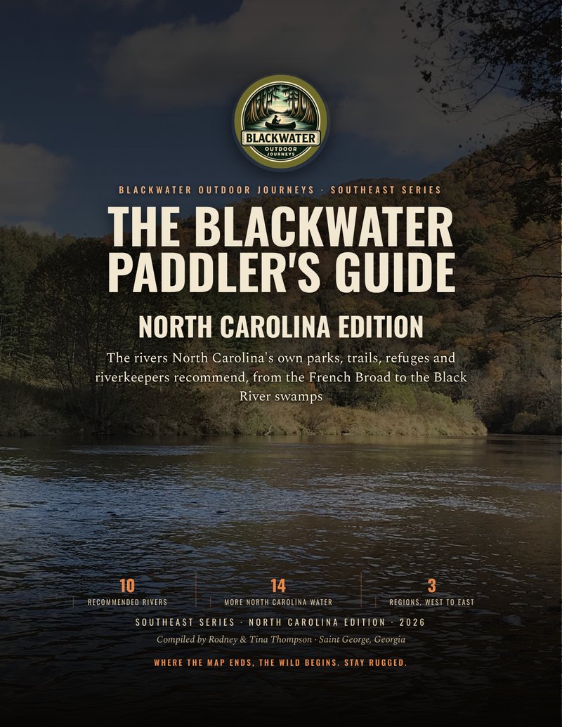
The Paddler's Guide covers 24 rivers, creeks and water trails in North Carolina. Each entry below is taken from the book: the class and character of the water, best season, permits and access, the gauge to watch, runs with mileage, camping, hazards and who recommends it. Check the gauge and the source before you launch.
The Mountains
The French Broad from Brevard to Hot Springs, the gentle New River in the northwest corner, and the Green, from a family float to the Narrows. Recommended by MountainTrue, NC State Parks, NC State Trails and American Whitewater. We have not paddled these yet.
Recommended · The Mountains
French Broad River
NC State Trails calls it one of the oldest rivers in the world; it has been a state trail since 1987. Most of it is gentle water with occasional class I and II rapids, and short flatwater sections near Brevard. Section 9, Barnard to Hot Springs, is class III and IV and only for experienced paddlers. Otters, wiped out by the 1930s, were brought back between 1990 and 1995.
- Class
- Class I to IV
- Where
- Transylvania, Henderson, Buncombe and Madison counties, Rosman to Hot Springs
- Best season
- American Whitewater calls Section 9 runnable pretty much all the time. Check the gauge for the rest of the river.
- Length
- 115 miles in North Carolina, from Rosman to the Tennessee line.
- Permit and access
- No river permit is published. Day use at MountainTrue's paddle-in campsites is free; an overnight stay needs a reservation.
- Gauge
- USGS 03453500 at Marshall sits upstream of Section 9, and 03451500 is at Asheville. No paddling range is quoted here, so read the level and the trend together. Read it live in the CWS app before you launch.
- Outfitters
- MountainTrue lists rental outfitters on its French Broad Paddle Trail site. The Hot Springs take-out is the Nantahala Outdoor Center's river access. Set up a shuttle yourself or through an outfitter, and run Section 9 with someone who knows it.
- Camping
- MountainTrue keeps campsites along the trail that you can only reach from the river. Day use is free and welcome. An overnight stay needs a reservation.
- Hazards
- Three run-of-river dams need a portage: Craggy Dam in Woodfin (13 ft), Capitola Dam in Marshall (9 ft) and Redmon Dam (30 ft). MountainTrue says Section 9 has serious hazards and is not for beginners.
- The runs
- Barnard Park to Stackhouse Boat Launch (4.5 mi). The shorter, more common Section 9 run. Class III to IV. Mileage from MountainTrue's river miles.
Barnard Park to NOC Hot Springs River Access (8.2 mi). The full Section 9, class III to IV, by American Whitewater's count. - Put-ins and take-outs
- Barnard Park (launch, river mile 100); Stackhouse Boat Launch (launch / take-out, river mile 104.5); NOC Hot Springs River Access (take-out, river mile 108.5)
- Recommended by
- MountainTrue (French Broad River Paddle Trail); NC State Trails (French Broad River State Trail); American Whitewater
Suggested: Section 9, Barnard Park to Hot Springs (8.2 mi)
- For experienced whitewater paddlers only. Put in at Barnard Park, river mile 100. Stackhouse Boat Launch at mile 104.5 is the short-run exit. Run on to the NOC Hot Springs River Access, 8.2 miles in all, class III to IV.
Packed lunch and snacks in a dry bag. One gallon per person for the day.
Recommended · The Mountains
New River
A shallow, gentle mountain river and a National Wild and Scenic River. New River State Park has seven accesses along it, and NC State Parks says every one of them lets you launch a kayak or a tube. The hellbender, the largest salamander in the U.S., lives in this valley along with 14 rare and threatened plant species.
- Class
- Shallow and gentle
- Where
- Ashe and Alleghany counties, about 35 miles northeast of Boone
- Best season
- No best season is published. Day use at the park is free; check park hours and camping dates with NC State Parks. Times may change. Check the official site for current times.
- Length
- 26.5 miles of the NC main stem and South Fork are National Wild and Scenic.
- Permit and access
- No fee for day use at New River State Park. Camping carries a fee. Elk Shoals Access is day use only.
- Gauge
- USGS 03161000, South Fork New River near Jefferson, is the gauge. No paddling range is quoted here. It is a shallow river, so read the level and the trend together. Read it live in the CWS app before you launch.
- Outfitters
- No outfitter is listed for this river. The park's accesses sit close together, so plan a short shuttle of your own between them.
- Camping
- The park has tent sites, including paddle-in sites. Wagoner Access has walk-in or paddle-in sites of its own and paddle-in camping down at the Riverbend and Peaks area. Camping carries a fee.
- Hazards
- A gentle river still rises fast after mountain rain. Give downed trees room, and stay off it when the gauge is climbing.
- The runs
- N.C. 88 Bridge to Wagoner Access (5 mi). About 2.5 hours, the park map says.
Wagoner Access to Riverbend Campsites (1.5 mi). About an hour. Paddle-in camping.
Prather's Creek Campsites to Kings Creek Access (3 mi). About 1.5 hours. - Put-ins and take-outs
- Elk Shoals Access (day-use access); Wagoner Access (launch, paddle-in campsites); U.S. 221 Access (launch); Kings Creek Access (launch / take-out)
- Recommended by
- NC State Parks (New River State Park); National Wild and Scenic Rivers System
Suggested: N.C. 88 Bridge to Wagoner Access (5 mi)
- Put in at the N.C. 88 bridge and float 5 miles to Wagoner Access. The park map puts it at about 2.5 hours. To make it an overnight, go 1.5 miles more, about an hour, to the Riverbend paddle-in campsites.
Packed lunch and snacks. Pack out every scrap. One gallon per person for the day, more if you camp.
Recommended · The Mountains
Green River
The Green runs in three sections. The Lower Green is class II, the family section. The Upper Green is class II to III+. Between them sits the Narrows, class IV to V and expert only, and American Whitewater says once you pass Big Hungry you are in it quickly. The Wildlife Resources Commission's Green River Game Land plan covers all three sections.
- Class
- Class II to V by section
- Where
- Henderson and Polk counties, near Saluda
- Best season
- No season is published. Hurricane Helene destroyed the powerhouse that made the Green's dam releases, so flows now depend on rain. Check the level before you drive.
- Length
- Upper Green 3.8 miles and Lower Green 6.1 miles, American Whitewater says.
- Permit and access
- No river permit is published. The big Upper Green lot on Gallimore Road is private and gated, with an annual key fee; there are 6 to 8 public spaces at the trailhead.
- Gauge
- No USGS gauge is named for these runs, and no paddling range is quoted here. Ask the outfitter or check American Whitewater for the day's flow. Read it live in the CWS app before you launch.
- Outfitters
- Green River Adventures in Saluda runs Lower Green inflatable kayak trips of 3 or 4.5 miles with transportation and gear, and rents stand up paddleboards, whitewater kayaks and gear.
- Camping
- No river campsites are listed for these runs. Plan a day trip and stay in town or at a campground off the river.
- Hazards
- The Upper Green take-out is a 0.7 mile hike that climbs 300 feet, starting just above the Hungry River. Miss it and you are headed into the Narrows. On the Lower Green, watch for floating debris and changed rapids since Hurricane Helene.
- The runs
- Fishtop Access to Big Rock Take-Out (Lower Green) (6.1 mi). Class II. The family section.
Tuxedo Powerplant to the trail above the Hungry River (Upper Green) (3.8 mi). Class II to III+. Hike out 0.7 mile to Gallimore Road. - Put-ins and take-outs
- Fishtop Access (Lower Green put-in); Big Rock Take-Out (Lower Green take-out)
- Recommended by
- American Whitewater; NC Wildlife Resources Commission (Green River Game Land)
Suggested: Lower Green with an outfitter (3 or 4.5 mi)
- Book a Lower Green inflatable kayak trip with Green River Adventures in Saluda. Pick the 3 mile run, 2 to 3 hours, or 4.5 miles, 3 to 4 hours. They handle the transportation and the gear.
Snacks and lunch for after the run. One liter per person on the water, more waiting in the car.
The Piedmont
Big rivers and old mill dams: the Yadkin River State Trail, the Deep River's shoals and portages, the Neuse through Raleigh and the Cape Fear under Raven Rock. Recommended by NC State Trails, the Yadkin and Deep River riverkeepers, NC State Parks and the City of Raleigh.
Recommended · The Piedmont
Yadkin River
A big Piedmont river and a state paddle trail since 1985. The trail starts below the dam at Kerr Scott Reservoir and runs 163 miles to the Uwharrie River at Morrow Mountain State Park. Native Americans lived off this river more than 10,000 years ago. The blue heron on the trail blaze is for the rookeries along its banks.
- Class
- Class I to II on the trail
- Where
- From the Kerr Scott Reservoir dam near Wilkesboro to Morrow Mountain State Park
- Best season
- No best season is published. The outfitters on the upper river keep their own seasons, so check with them first.
- Length
- The state trail is 163 miles. The whole river runs 203 miles to Lake Tillery.
- Permit and access
- No river permit is published for the state trail.
- Gauge
- USGS 02111000 at Patterson reads the headwaters above Kerr Scott Reservoir. USGS 02116500 at Yadkin College reads the middle river. No paddling range is quoted here. Read it live in the CWS app before you launch.
- Outfitters
- Upper Yadkin Outfitters rents kayaks and canoes with shuttle service on the upper Yadkin. North Carolina River Riders in Ronda rents tubes, kayaks and canoes, with PFDs and a shuttle.
- Camping
- The Yadkin Riverkeeper lists two primitive campsites 0.8 mile below Shoals Access, and Piedmont Land Conservancy plans island campsites near mile 95.
- Hazards
- One upper reach, SR 1372 to US 321, is class IV+ on American Whitewater's list. It is not a float. On the trail itself, give downed trees and bridge pilings room.
- The runs
- Yadkin Shores Access to Shoals Access (16.9 mi). Class I to II. A full day, the Yadkin Valley river brochure says.
Donnaha to Old 421 Park Access (7 mi). Trail mile markers 99 to 92, past the Yadkin islands near mile 95.
Kerr Scott tailwaters to Morrow Mountain State Park (163 mi). The whole Yadkin River State Trail. - Put-ins and take-outs
- Yadkin Shores Access (launch); Shoals Access (launch / take-out, trail mile 105); Donnaha Access (launch, trail mile 99); Old 421 Park Access (take-out, trail mile 92)
- Recommended by
- NC State Trails (Yadkin River State Trail); Yadkin Riverkeeper; Town of Jonesville (Yadkin Valley river brochure)
Suggested: Yadkin Shores Access to Shoals Access (16.9 mi)
- A long day of class I to II water on the upper trail. Put in at Yadkin Shores Access and take out at Shoals Access, trail mile marker 105. Start early. At 16.9 miles, this is a full day in a canoe.
A real lunch and plenty of snacks for a long day. One gallon per person, more in summer heat.
Recommended · The Piedmont
Deep River
The Deep River State Trail is both a land trail and a paddle trail for its whole length, and that is rare. The water is class I and II rapids between old dams, with some flat pools and a beginner stretch through conservation land. The Deep River Riverkeeper keeps the list of accesses, runs and portages that this page is built on.
- Class
- Class I to II, with dams
- Where
- Randolph County down through Franklinville and Carbonton to Moncure
- Best season
- No best season is published. Check the gauge and the riverkeeper's access page before you go.
- Length
- A state trail on land and water for its whole length, authorized in 2007.
- Permit and access
- No river permit is published. The Deep River Riverkeeper warns that steep banks make the river hard to reach in many places.
- Gauge
- USGS 02102000 at Moncure reads the lower river. No paddling range is quoted here. Read it live in the CWS app before you launch.
- Outfitters
- No outfitter is listed for this river. Plan your own shuttle between the riverkeeper's named accesses.
- Camping
- No river campsites are listed. Treat these as day runs.
- Hazards
- Dams. Central Falls is a 25 ft hydroelectric dam: stay back and exit left near the hydro building. Get out at Cedar Falls Dam and portage on the right to avoid class IV rapids. The Cedar Falls bridge is not an official access.
- The runs
- Carbonton to McIver Landing (6.1 mi). Beginner water, minor rapids and class I, through conservation land.
Bridge at Cedar Falls to Franklinville (4.3 mi). Intermediate. Class I and II, one dam and one old dam. The put-in at the Cedar Falls bridge is not an official access.
Riverside Park Franklinville to NC 42 Bridge at Coleridge (9.1 mi). Advanced. Class I and II, two dams, a long day. The Coleridge take-out is private land behind a locked gate; the landowner has let paddlers walk in. - Put-ins and take-outs
- Riverside Park Franklinville (launch)
- Recommended by
- NC State Trails (Deep River State Trail); Deep River Riverkeeper
Suggested: Carbonton to McIver Landing (6.1 mi)
- The riverkeeper's beginner run. Put in at Carbonton and take out at McIver Landing, 6.1 miles of minor rapids and class I water through conservation land. Check the Moncure gauge the morning you go.
Packed lunch and snacks. One gallon per person for the day.
Recommended · The Piedmont
Neuse River
The Neuse leaves Falls Lake and runs right through Raleigh. The city keeps six launches for canoes and kayaks along 17 miles below Falls Lake Dam, part of the Neuse River Blueway plan it adopted in 2021. Downstream, at Cliffs of the Neuse State Park, the river runs under 90-foot bluffs.
- Class
- Moving water
- Where
- Wake, Johnston and Wayne counties, Falls Lake Dam down to Cliffs of the Neuse
- Best season
- No best season is published. Raleigh's river accesses are open sunrise to sunset. Times may change. Check the official site for current times.
- Length
- The Neuse River Blueway covers 25 miles through Raleigh and Wake County.
- Permit and access
- No river permit. Raleigh's access lots are not for overnight use, and cars may not be left there. Cliffs of the Neuse charges for camping.
- Gauge
- USGS 02087500 near Clayton reads the river below Raleigh, and 02089000 near Goldsboro reads it above Cliffs of the Neuse. No paddling range is quoted here. Read it live in the CWS app before you launch.
- Outfitters
- No outfitter is listed for the Blueway, so plan your own shuttle.
- Camping
- No camping at Raleigh's river accesses. Cliffs of the Neuse State Park has camper cabins, tent sites, trailer and RV sites and group tent sites. Camping carries a fee.
- Hazards
- Raleigh warns that fast current can push you into downed trees, boulders, log jams and bridge footings that trap boats and people underwater. The bottom is uneven. Get off the water at the first thunder.
- The runs
- Falls Dam to Thornton Road (4.7 mi). The first leg of the Blueway below Falls Lake Dam.
Thornton Road to River Bend Park (5.6 mi). Then 1 mile more to Buffaloe Road.
Buffaloe Road to Anderson Point (6 mi). Poole Road is 1.5 miles below Anderson Point. - Recommended by
- City of Raleigh Parks (Neuse River Blueway); NC State Parks (Cliffs of the Neuse State Park)
Suggested: Falls Dam to River Bend Park (10.3 mi)
- Launch at the Falls Dam access and paddle 4.7 miles to Thornton Road, then 5.6 miles more to River Bend Park. The accesses are open sunrise to sunset, so start early and leave nothing in the lot overnight.
Packed lunch and snacks. One gallon per person for the day.
Recommended · The Piedmont
Cape Fear River
At Raven Rock State Park a 150-foot crystalline cliff stands over the water, with Lanier Rapids, Fish Traps Rapids and the remains of the Northington Lock and Dam along the shore. Below Buckhorn Dam, American Whitewater rates it class I to II with a class III spot. Watch for bald eagles, ospreys and great blue herons.
- Class
- Class I to III
- Where
- Harnett County, from Buckhorn Dam past Lillington and Raven Rock State Park
- Best season
- No best season is published. The Lillington outfitter stops its hourly rentals in higher water, for safety.
- Length
- The Cape Fear River Canoe Trail runs through Raven Rock State Park.
- Permit and access
- No fee for day use at Raven Rock State Park. All camping there is by reservation, no walk-ups. Paddle-in sites list at $20 a night.
- Gauge
- USGS 02102500 at Lillington is the gauge. Read it live in the CWS app before you launch.
- Outfitters
- Cape Fear River Adventures in Lillington rents kayaks, canoes and paddleboards for a self-guided paddle that starts and ends at its office, no shuttle needed. It stops that option in higher water.
- Camping
- Raven Rock Canoe Camp has six sites for up to six campers each, a vault toilet and fire rings with grills. The park has no kayak or canoe launch of its own. Reserve ahead.
- Hazards
- Lanier Falls and the Fish Traps are rapids on the canoe trail. Raven Rock State Park says paddling is not recommended above 3.5 feet on the Lillington gauge. Buckhorn Dam is the top of the run.
- The runs
- Buckhorn Dam to Lillington (14.45 mi). Class I to II with a class III spot, American Whitewater says.
- Recommended by
- NC State Parks (Raven Rock State Park); American Whitewater
Suggested: Buckhorn Dam to Lillington (14.45 mi)
- Check the Lillington gauge first; the state park says paddling is not recommended above 3.5 feet. Put in at the Buckhorn Dam access and run 14.45 miles of class I to II water, with a class III spot, to the Lillington take-out.
A real lunch and snacks for a long day. One gallon per person for the day.
The Coastal Plain
Blackwater country: the Lumber, a National Wild and Scenic River; the Black and its ancient cypress; and the Roanoke's camping platforms in the biggest bottomland forest in the mid-Atlantic. Recommended by NC State Parks, The Nature Conservancy, Cape Fear River Watch, NC State Trails and Roanoke River Partners.
Recommended · Coastal Plain
Lumber River
A long, meandering blackwater river in the flat Coastal Plain, and the only blackwater river in North Carolina that is a National Wild and Scenic River. The upper river became the state's first recreational water trail in 1978 and a national canoe trail in 1981. The belted kingfisher and the rare Carolina bogmint live along it.
- Class
- Flatwater, blackwater
- Where
- Hoke, Scotland, Robeson and Columbus counties, Wagram to Fair Bluff
- Best season
- The park's accesses open at 7 a.m. and close at 6 p.m. in January and February, 9 p.m. from May through September. Times may change. Check the official site for current times.
- Length
- 115 miles long. Two segments, 81 miles in all, are National Wild and Scenic.
- Permit and access
- No fee for day use at Lumber River State Park. Camping carries a fee. If you reserve a site, confirm where it is before you go.
- Gauge
- USGS 02134500 at Boardman sits on the lower trail above Princess Ann, and 02133624 near Maxton reads the upper river. The park warns the level swings, so plan with the trend. Read it live in the CWS app before you launch.
- Outfitters
- No outfitter is listed for this river. The park's paddle map gives the miles and hours between its 21 numbered accesses, so plan your own shuttle from it. Times may change. Check the official site for current times.
- Camping
- Chalk Banks and Princess Ann both have camping, including paddle-in tent sites, and the paddle map marks more paddle-to camping between accesses. Camping carries a fee.
- Hazards
- Fallen trees and debris. Never float over an obstruction, the park says, and add time for sandbars and exposed hazards when the water is low. Cell service is limited on the river.
- The runs
- SR 1412 (N Turnpike Rd) to Chalk Banks (6 mi). About 3 hours at the park's 2 mph planning pace.
Boardman BAA (U.S. 74) to Princess Ann (9.4 mi). About 5 hours. Camping at Princess Ann.
Princess Ann to Fair Bluff BAA (N.C. 904) (11.7 mi). About 6 hours, the last leg to Fair Bluff. - Put-ins and take-outs
- Boardman Boating Access Area (launch, U.S. 74); Princess Ann Access (launch, camping); Fair Bluff Boating Access Area (take-out, N.C. 904)
- Recommended by
- NC State Parks (Lumber River State Park); National Wild and Scenic Rivers System; Winyah Rivers Alliance (Lumber Riverkeeper)
Suggested: Boardman to Fair Bluff, two days (21.1 mi)
- Launch at Boardman Boating Access Area on U.S. 74 and paddle 9.4 miles, about 5 hours by the park's paddle map, to Princess Ann. Camp at the park's Princess Ann access; reserve ahead and confirm your site.
- Paddle 11.7 miles, about 6 hours, from Princess Ann to Fair Bluff Boating Access Area on N.C. 904. Start early. Fallen trees and sandbars add time when the water is low.
Two lunches, one camp supper and breakfast, plus snacks. Pack out every scrap. One gallon per person per day, plus a filter.
Recommended · Coastal Plain
Black River
A true blackwater river, shallow and full of obstacles, and North Carolina lists it as Outstanding Resource Waters. In Three Sisters Swamp, two bald cypress have been dated to at least 2,624 and 2,088 years old, and only a canoe or kayak can get in among them. River otters, black bears, wood ducks and the odd alligator live along it.
- Class
- Blackwater, advanced
- Where
- Sampson, Bladen and Pender counties, from Ivanhoe down toward the Cape Fear
- Best season
- The Nature Conservancy says the water level swings a lot through the year. In dry spells, expect to haul over logs and trees.
- Length
- The state's river study covers 45 miles through Sampson, Bladen and Pender Counties.
- Permit and access
- Public access is limited to bridges and Wildlife Resources Commission ramps. Henry's Landing is private and charges $5 a boat.
- Gauge
- USGS 02106500 near Tomahawk is the gauge. No paddling range is quoted here. Low water means sandbars and portages, so read the level and the trend together. Read it live in the CWS app before you launch.
- Outfitters
- Kayak Carolina runs guided and self-guided Black River trips and delivers the gear. Six Runs River Adventures in Sampson County runs guided or self-guided trips with drop-off and pick-up. Coconut Jack's Tours guides day trips when the water is high enough.
- Camping
- No public campsites are listed on the river. Six Runs River Adventures offers overnight trips with lodging.
- Hazards
- Cape Fear River Watch calls Ivanhoe to Henry's Landing a more advanced paddle, not for beginners: expect snags, strainers, sandbars, low water and portages around downed trees.
- The runs
- Ivanhoe Boating Access Area to Henry's Landing (about 9 mi). About 3.5 hours of paddling. Advanced, with portages likely.
Henry's Landing to the N.C. 53 bridge landing (9.5 mi). Through Three Sisters Swamp: 5 miles to the swamp, half a mile through, 4 miles out. - Put-ins and take-outs
- Ivanhoe Boating Access Area (launch); Henry's Landing (private landing, fee); Newby's Landing (private landing); Hunts Bluff Boating Access Area (launch)
- Recommended by
- The Nature Conservancy in North Carolina; Cape Fear River Watch; North Carolina Sea Grant
Suggested: Through Three Sisters Swamp (9.5 mi)
- Launch at Henry's Landing, 1.5 miles below the SR 1550 bridge ($5 a boat). Paddle 5 miles to the top of Three Sisters Swamp, half a mile through the old cypress, then 4 miles to the landing at the N.C. 53 bridge.
Packed lunch and snacks in a dry bag. One gallon per person for the day.
Recommended · Coastal Plain
Roanoke River
A big river through what NC State Trails calls the largest and least disturbed bottomland hardwood forest in the mid-Atlantic. The Roanoke River State Trail runs from Roanoke Rapids to the Albemarle Sound, and most paddlers should plan on several days. Look for black bears, beavers, river otters, bobcats and more than 200 kinds of birds.
- Class
- Big river, multi-day
- Where
- Halifax to Washington County, Roanoke Rapids to the Albemarle Sound
- Best season
- No best season is published. Roanoke River Partners says book platforms well ahead for spring, fall and holidays.
- Length
- The state trail runs from Roanoke Rapids all the way to the Albemarle Sound.
- Permit and access
- Every camping platform needs a reservation. Check current closure notices for refuge-managed lands before using those sections.
- Gauge
- Roanoke River Partners advises against travel when USGS 02081054 at Williamston reads above about 10 feet, or when Roanoke Rapids Dam releases more than 18,000 cfs. Dominion Energy posts projected releases. Read it live in the CWS app before you launch.
- Outfitters
- Roanoke River Partners lists shuttle drivers in Williamston. The Roanoke Cashie River Center in Windsor lists kayak and canoe rentals.
- Camping
- The camping platforms are the heart of this trail. Every one needs a reservation, and all are primitive: no running water, electricity or flush toilets. Most allow no open fires, so bring a stove.
- Hazards
- Dam releases can change the flow quickly. Headwinds on Broad Creek can make paddling hard. Avoid long upstream legs. Check closure notices for refuge-managed lands before you go.
- The runs
- Astoria Boat Ramp to Barred Owl Roost and back (4 mi). Two days, one night. Easy to moderate, Roanoke River Partners says.
Williamston to Astoria Boat Ramp, around Devil's Gut (19 mi). Three days: Conine and Barred Owl Roost platforms. Moderate.
Williamston to Hwy 45 Bridge Boat Ramp (27 mi). Four days, platform to platform. Moderate. - Put-ins and take-outs
- Weldon (NCWRC boating access area); Odom (NCWRC boating access area); Lewiston Woodville (NCWRC boating access area); Hamilton (NCWRC boating access area); Williamston (NCWRC boating access area); Plymouth Water Street (NCWRC boating access area); Edwards Ferry - 258 Access (NCWRC boating access area); Astoria Landing Access (NCWRC boating access area); NC Highway 45 Bridge Access (NCWRC boating access area); Conaby Creek Access (NCWRC boating access area); Sans Souci Ferry - Cashie River Access (Roanoke River State Trail access)
- Recommended by
- NC State Trails (Roanoke River State Trail); Roanoke River Partners; U.S. Fish and Wildlife Service (Roanoke River NWR)
Suggested: Owl Overnight, Astoria Boat Ramp (4 mi)
- Reserve Barred Owl Roost first. From the Astoria Boat Ramp at Jamesville, paddle a short way up the Roanoke into Devil's Gut, 1 mile up the Gut to Lower Deadwater Creek, then the last 0.75 mile to the platform.
- Explore the tupelo swamp around the platform, then retrace your route to the Astoria Boat Ramp. High flow makes the upstream legs harder.
Camp supper, breakfast and lunch, cooked on a stove. Pack out all trash. Bring 2 to 3 liters per person per day. Roanoke River Partners does not recommend filtering the river.
More North Carolina Water
Fourteen more rivers, millponds and refuge trails that a North Carolina source recommends. Shorter entries: start here, then check the source before you go.
Mountains · Mountain Whitewater
Nantahala River
The Nantahala Gorge run: 8.06 miles of class II to III from the Duke Energy public launch to the NOC take-out, American Whitewater says. Nantahala Falls, or Lesser Wesser, is the class III near the end. NOC rents rafts and duckies with a shuttle to the put-in.
- Best run
- Public Launch Site to NOC Take-Out Site (8.06 mi)
- Gauge
- USGS 03505550
- Hazards
- Business Hole can hold boats and swimmers. Worser Wesser, class IV+, is just below the NOC take-out. Do not miss it.
- Recommended by
- American Whitewater; Nantahala Outdoor Center
Mountains · Mountain Whitewater
Pigeon River
A dam release run from Waterville, NC, into Tennessee: 4.3 miles of class II to III+ from Waterville to Hartford Bridge. Releases run Memorial Day to Labor Day, Tuesday, Wednesday, Thursday and Saturday, noon to 6 p.m. For 2026 the put-in is the bridge off the Waterville exit.
- Best run
- Waterville to Hartford Bridge (4.3 mi)
- Gauge
- USGS 03460795
- Hazards
- Hurricane Helene reshaped this river in 2024. Expect metal, strainers and downed trees in the channel.
- Recommended by
- American Whitewater
Mountains · Mountain River
Little Tennessee River
American Whitewater's North Carolina run is 22 miles from NC 28 to US 19, class I to II with a possible class III, dropping 11 feet a mile. The Needmore Game Land lines both banks from the US 19/74 bridge up to Burningtown Creek.
- Best run
- NC 28 to US 19 (22 mi)
- Gauge
- USGS 03503000
- Hazards
- An unexpected class III, a breaking wave with a hole behind it, waits near the end. Some banks have no public access.
- Recommended by
- American Whitewater; NC Wildlife Resources Commission (Needmore Game Land)
Mountains · Mountain Whitewater
Linville River
Expert only. American Whitewater rates Linville Gorge, Linville Falls to Lake James, class V for 16.9 miles at 110 feet a mile. Camping permits (free, with a $6 Recreation.gov reservation fee) are needed on weekends and holidays, May 1 to Oct. 31.
- Best run
- Linville Falls to Lake James (16.9 mi)
- Gauge
- USGS 02138500
- Hazards
- Class V rapids such as Entrance to Jailhouse, and Low No Go is a portage. No boating in the Parkway's stretch of the river.
- Recommended by
- American Whitewater; USDA Forest Service (Linville Gorge Wilderness)
Mountains · Big River
Catawba River
The Upper Catawba River Trail runs 82 miles from Black Bear Access on Lake James to Lookout Access on Lake Lookout Shoals, with 24 boating accesses. In Morganton it passes Greenlee Ford, Freedom Park, Catawba Meadows Park and Rocky Ford.
- Best run
- Black Bear Access to Lookout Access (82 mi)
- Gauge
- USGS 02141500
- Hazards
- The trail has four portages. Know where each one is before you launch.
- Recommended by
- City of Morganton (Upper Catawba River Trail)
Piedmont · River
Dan River
In 2021 the state made 90 miles of the Dan in Surry, Stokes and Rockingham counties a paddle trail. The river crosses the Virginia line eight times on its 214 mile run. Dan River Company rents canoes and kayaks with shuttles at Hanging Rock State Park.
- Best run
- Dan River Company's Preserve to Park beginner trip (6.2 mi)
- Gauge
- USGS 02068500, USGS 02071000
- Hazards
- Know your take-out before you launch. The endangered logperch lives in these riffles, so leave them as you found them.
- Recommended by
- NC State Trails (Dan River State Trail); Dan River Basin Association
Piedmont · River
Haw River
The Haw River Trail has 14 paddle accesses covering the whole river through Alamance County, from Brooks Bridge to Union Bridge. Old mill dams back it up into lake-like flatwater. Down near Bynum, Section 8 is the Triangle's go-to class I to II run.
- Best run
- Chicken Bridge Road to US 15/501 access (6.7 mi)
- Gauge
- USGS 02096960
- Hazards
- High water makes the Haw extremely dangerous, the trail says. Section 8 needs at least 200 cfs on the Bynum gauge.
- Recommended by
- Haw River Trail; Great Outdoor Provision Co.
Coastal Plain · Big River
Tar River
A big Coastal Plain river through Rocky Mount and Tarboro. The Wildlife Resources Commission maps ramps at Sunset Park and Battle Park in Rocky Mount, Dunbar Bridge, and Bells Bridge near Tarboro. Sound Rivers samples the water weekly from Memorial Day to Labor Day.
- Gauge
- USGS 02083500
- Hazards
- No run with a published mileage is listed. Plan short trips between the ramps and read the gauge first.
- Recommended by
- NC Wildlife Resources Commission; Sound Rivers
Coastal Plain · Tidal
Chowan River
Creeks and millponds off a wide river. The Bennett's Millpond and Rockyhock Creek paddle trail runs 5 miles from the old milldam. There are camping platforms on Holladay Island, and ramps at Shoups Landing and Gatlington Landing; the Gatesville ramp is closed for repairs from October 1, 2026.
- Best run
- Bennett's Millpond and Rockyhock Creek trail (5 mi)
- Gauge
- None published. Look at the water before you launch.
- Hazards
- The basin guide is older, so confirm each access before you drive. Wind on the open river can build waves.
- Recommended by
- Albemarle-Pamlico National Estuary Partnership; NC Wildlife Resources Commission
Coastal Plain · Lake And Swamp
Merchants Millpond
A 760-acre millpond more than 190 years old, under old-growth cypress hung with Spanish moss. Alligators have been seen here at the north end of their range. The park rents boats, and Bennett's Creek below it has a 5.7 mile Gatesville paddle trail.
- Best run
- Gatesville Paddle Trail, Bennett's Creek (5.7 mi)
- Gauge
- None published. Look at the water before you launch.
- Hazards
- The park's tent and trailer campground is closed until further notice. Check before you plan a night.
- Recommended by
- NC State Parks (Merchants Millpond State Park)
Coastal Plain · Tidal
Pasquotank River
Elizabeth City sits on the Pasquotank. The city has public launches at College Park, formerly Dog Corner Park, and Waterfront Park, and self-service kayak rentals, paddles and life vests included, at College Park. The Albemarle paddle trail map covers the river and Sawyers Creek.
- Gauge
- None published. Look at the water before you launch.
- Hazards
- Open water near town. Watch for boat traffic and the wind.
- Recommended by
- City of Elizabeth City; Albemarle Resource Conservation and Development Council
Coastal Plain · Lake And Swamp
Alligator River NWR
Four color-coded paddling trails start at the end of Buffalo City Road: a 1.5 mile loop, 2 miles to Sawyer Lake, 4 miles down Milltail Creek to the Alligator River and 5.5 miles up the creek to a second launch on Milltail Road.
- Best run
- Buffalo City Road to Milltail Road launch, blue trail (5.5 mi)
- Gauge
- None published. Look at the water before you launch.
- Hazards
- Remote refuge water. Tell someone your route. Commercial guided trips need a refuge permit.
- Recommended by
- U.S. Fish and Wildlife Service (Alligator River NWR)
Coastal Plain · Lake And Swamp
Pocosin Lakes NWR
Pocosin Lakes National Wildlife Refuge opens the Alligator and Scuppernong rivers and Frying Pan Lake to boats. Black bears are seen nearly year-round, and winter brings the waterfowl.
- Gauge
- None published. Look at the water before you launch.
- Hazards
- Daylight only. No camping or open fires, no boating on Pungo Lake, and no boats left on the refuge overnight.
- Recommended by
- U.S. Fish and Wildlife Service (Pocosin Lakes NWR)
Coastal Plain · Blackwater
Waccamaw River
The Waccamaw leaves Lake Waccamaw, the largest Carolina bay, and winds 43 miles through swamp to the South Carolina line. The Waccamaw Riverkeeper says Pireway Boat Ramp near Ash is the only public landing on that stretch.
- Gauge
- USGS 02109500
- Hazards
- A narrow, winding swamp channel. The state health advisory, the Riverkeeper notes, is no more than one meal a week of high-mercury fish like bass.
- Recommended by
- NC State Parks (Lake Waccamaw State Park); Winyah Rivers Alliance (Waccamaw Riverkeeper)